

Adina Sommer
Antique and Contemporary Art
Winzerer Str. 154
80797 München
telephone
+49 89 304714
business hours:
by appointment
Email
![]()


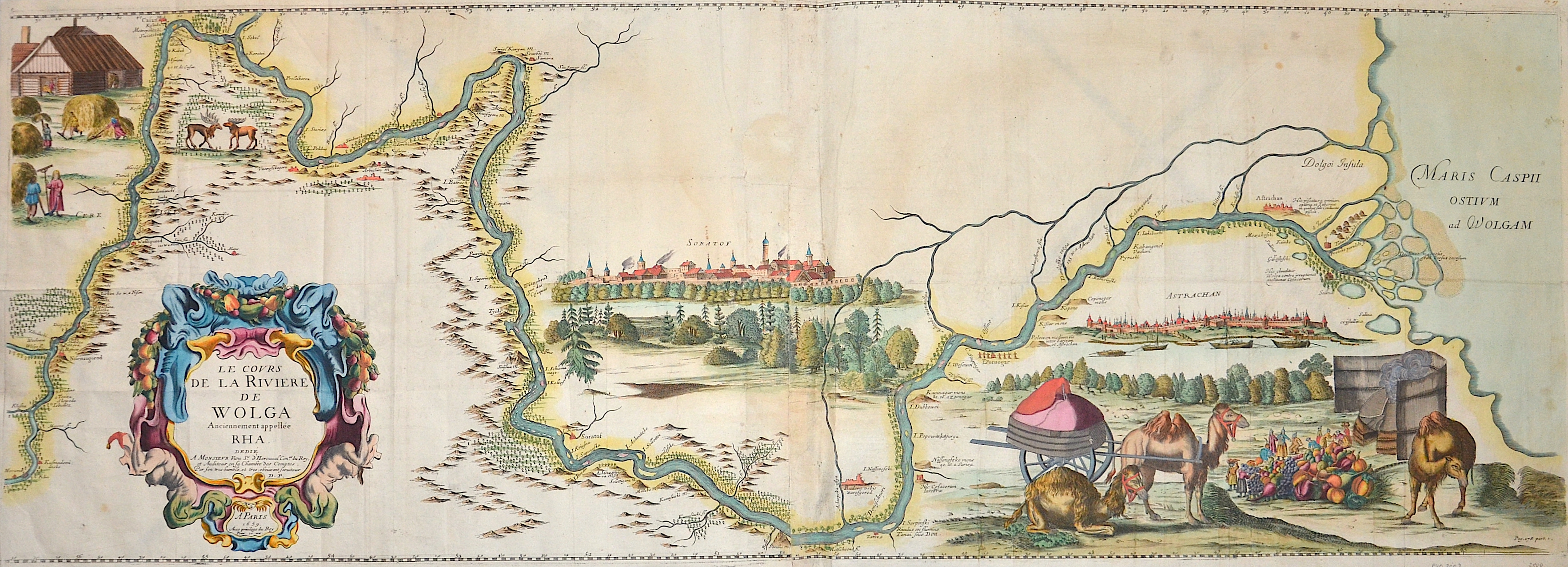
Le Cours de la Riviere de Wolga Anciennement appellee RHA.
| Article ID | EUO2002 |
Title | Le Cours de la Riviere de Wolga Anciennement appellee RHA. |
Map shows the lower Volga with magnificent cartouches and depictions of a Tatar market life, camels and rural scenery. Furthermore, a general view of the city of Soratov and Astrakhan located at the mouth of the Volga. | |
| Year | c. 1659 |
Artist | Olearius (1603-1671) |
Adam Olearius was a German travel writer, diplomat, and geographer. In the 1630s, he joined a failed Schleswig-Holstein trade mission to Russia and Persia, but his 1647 travel account became highly influential. It offered the first comprehensive description of Persia and a detailed view of 17th-century Russia. As court mathematician and librarian, he collected Oriental manuscripts, built a cabinet of curiosities, and created a three-meter globe in 1654. His geographic insights—such as the north-south orientation of the Caspian Sea and mapping of the Volga—significantly advanced cartography. His works remain milestones in early ethnography and geography. | |
Historical Description | Since the Caspian Sea is not a sea in the legal sense, it is not subject to the 1994 Convention on the Law of the Sea. The oldest cultural evidence can be found on inscriptions on Assyrian pottery and call it a "Southern Sea". the first popular name refers to the tribe of the Caspians who lived on the southwestern bank of the Caspian Caucasus, in today's Azerbaijan, the second refers to the bank near Hyrkania, a landscape on today's Iranian and southern Turkmen coast. The changing history of settlement led to numerous other names such as B. the Tatar name "Ag Deniz", White Sea. |
| Place of Publication | Paris |
| Dimensions (cm) | 38,5 x 109,5 cm |
| Condition | Missing part at upper center perfectly replaced |
| Coloring | colored |
| Technique | Copper print |