

Adina Sommer
Antique and Contemporary Art
Winzerer Str. 154
80797 München
telephone
+49 89 304714
business hours:
by appointment
Email
![]()


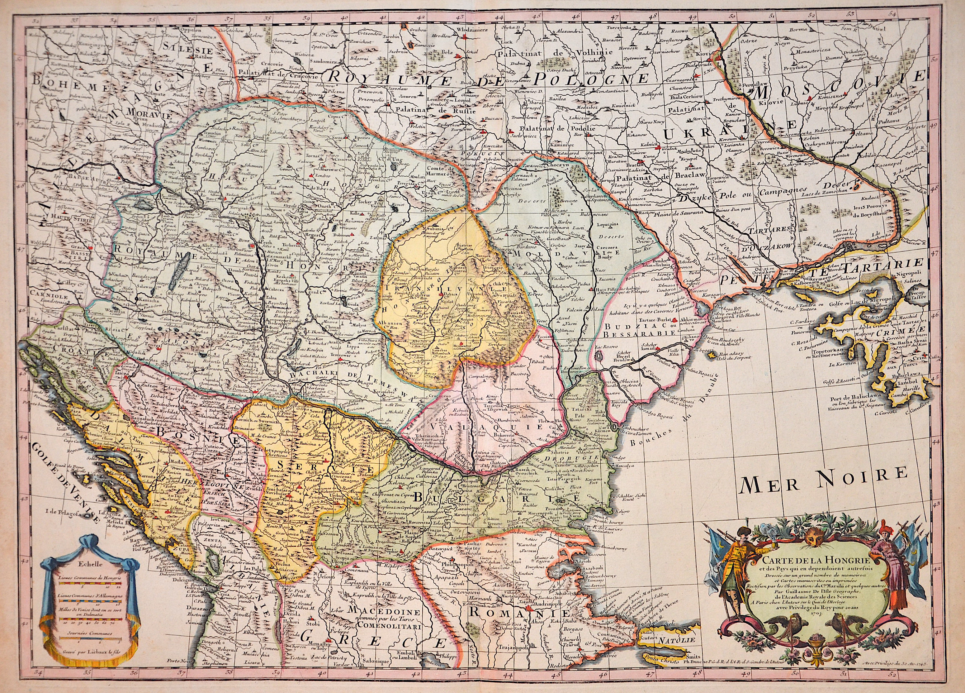
Carte de la Hongrie et des Pays qui en dependoient autrefois..
| Article ID | EUH0651 |
Title | Carte de la Hongrie et des Pays qui en dependoient autrefois.. |
Map shows Hungary, Tanzilvania, southern Poland (historical land in Galicia), Bosnia, Dalmatia, Serbia, Bulgaria, Wallachia, Moldavia, a title cartouche and a mileage scale cartouche. | |
| Year | dated 1745 |
Artist | L´Isle, de (1675-1726) |
Guillaume De L’Isle (1675–1726) was a renowned French cartographer famous for his accurate maps of Europe, the Americas, and Africa. He joined the French Académie Royale des Sciences, signing his maps as “Géographe de l’Académie,” and later became Premier Géographe du Roi in 1718, teaching geography to the Dauphin. De L’Isle mostly worked from his office, relying on a strong network of traveler reports and scientific updates, ensuring his maps were precise and honest. He openly noted uncertain information, such as a disputed river in Louisiana. In 1700, he won a legal case against Jean-Baptiste Nolin for plagiarism. Unlike the Sanson workshop, which often published outdated maps, De L’Isle focused on up-to-date, scientifically grounded cartography. | |
| Place of Publication | Paris |
| Dimensions (cm) | 47 x 65 cm |
| Condition | Very good |
| Coloring | colored |
| Technique | Copper print |