

Adina Sommer
Antique and Contemporary Art
Winzerer Str. 154
80797 München
telephone
+49 89 304714
business hours:
by appointment
Email
![]()


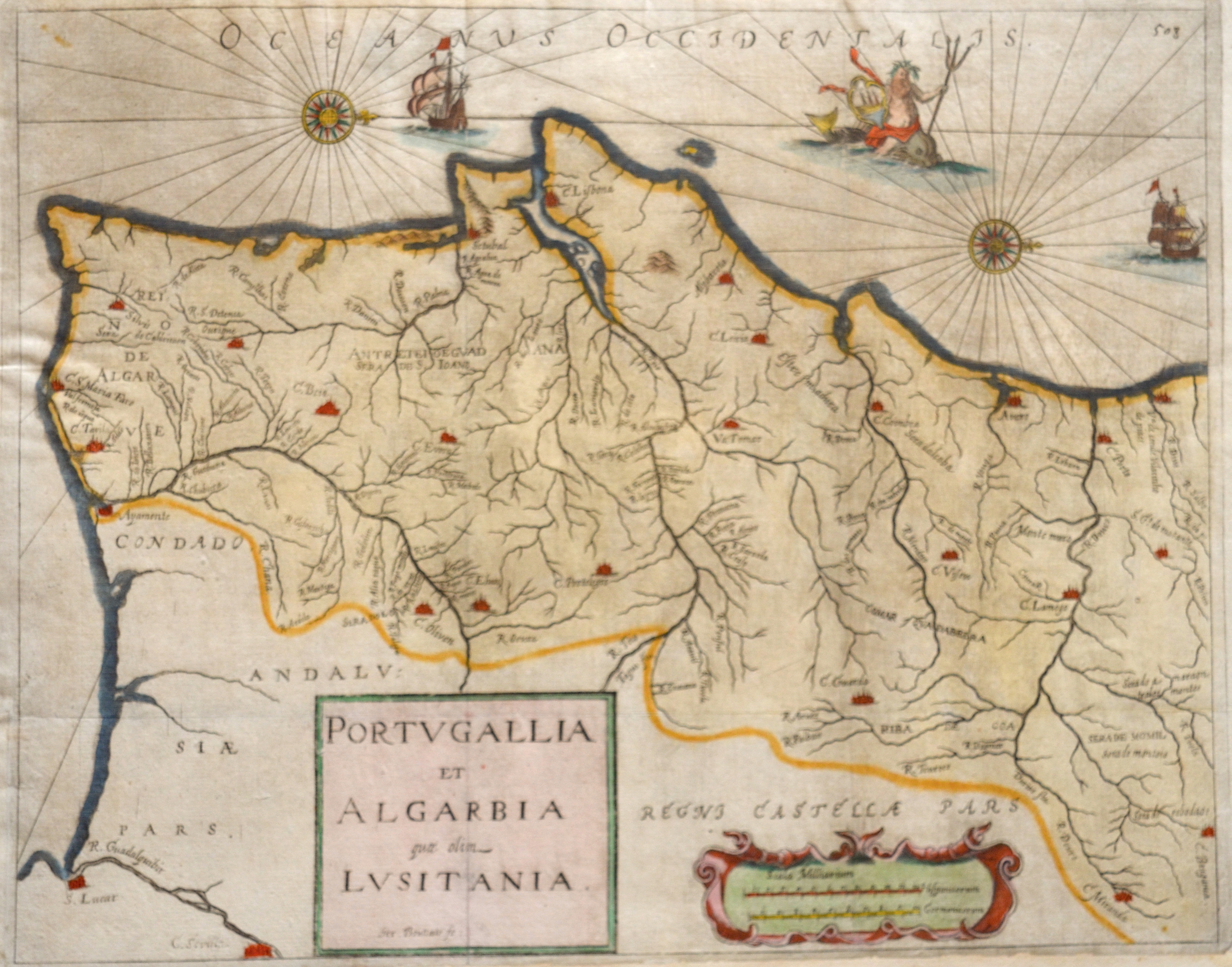
Portugallia et Algarbia quae olim Lusitania.
| Article ID | EUE4141 |
Title | Portugallia et Algarbia quae olim Lusitania. |
Detailed map depicts Portugal with the cities Lissabon, Setubal, Porto, Aveiro, Tomar, Leiria, Coimbra, Ayamonte, Beja, etc.. Decorative title cartouche, offshore ships, windrose and seamonster. | |
| Year | ca. 1670 |
Artist | Bouttats (1640-1695-96) |
Gaspar Bouttats (c. 1650–1696), Antwerp, was a Flemish engraver and etcher. He specialized in: Book engravings (title pages, illustrations), City views (e.g. Amsterdam, Bergen op Zoom, Deventer, Leiden), Topographical scenes (cities, fortifications, landscapes), Historical scenes (e.g. the assassination of Henry IV), Portraits, and Maps (e.g. Polonia Regnum). Many of his engravings were based on drawings by Jan Peeters I, a well-known draughtsman of topographical views. At the time, Antwerp was a major European center for book printing, map production, and copper engraving. There was a high demand for printed city views, war reports, fortification plans, and maps—driven by wars, trade, and growing scientific interest. His works are now held in museums such as the Rijksmuseum in Amsterdam. | |
Historical Description | Portugal is the oldest state on the Iberian Peninsula and one of the oldest in Europe, its territory having been continuously settled, invaded and fought over since prehistoric times. The pre-Celtic people, Celts, Carthaginians and Romans were followed by the invasions of the Visigoths and Suebi Germanic peoples. In the 15th and 16th centuries, Portugal established the first global empire, becoming one of the world's major economic, political and military powers. During this period, today referred to as the Age of Discovery, Portuguese explorers pioneered maritime exploration, notably under royal patronage of Prince Henry the Navigator and King John II, with such notable voyages as Bartolomeu Dias' sailing beyond the Cape of Good Hope (1488), Vasco da Gama's discovery of the sea route to India (1497–98) and the European discovery of Brazil (1500). During this time Portugal monopolized the spice trade, divided the world into hemispheres of dominion with Castille, and the empire expanded with military campaigns in Asia. However, events such as the 1755 Lisbon earthquake, the country's occupation during the Napoleonic Wars, the independence of Brazil (1822), and a late industrialization compared to other European powers, erased to a great extent Portugal's prior opulence. |
| Place of Publication | Antwerp |
| Dimensions (cm) | 32,5 x 41 cm |
| Condition | Lower margin enlarged |
| Coloring | colored |
| Technique | Copper print |