

Adina Sommer
Antique and Contemporary Art
Winzerer Str. 154
80797 München
telephone
+49 89 304714
business hours:
by appointment
Email
![]()


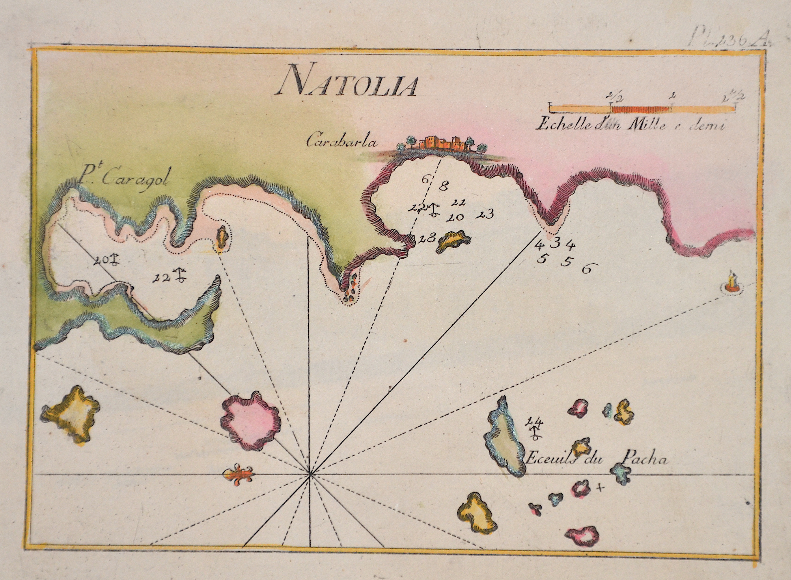
Natolia Pl. 236 A.
| Article ID | AST1380 |
Title | Natolia Pl. 236 A. |
Map shows the west coast of the Bodrum peninsula, from Gumusluk to Turgutreis. | |
| Year | ca. 1780 |
Artist | Roux (1725-1793) |
Joseph Roux (1725–1793), from Marseille, came from a family of hydrographers and marine cartographers. He ran a workshop-boutique at the Vieux-Port of Marseille, which he had taken over from his father. His main focus was the creation of nautical charts and plans of harbors, bays, and coastlines — particularly in the Mediterranean region.bIn 1764, for example, he published a series of twelve large sheets under the title Carte de la Mer Méditerranée en douze feuilles ("Map of the Mediterranean Sea in twelve sheets"). He produced chart sheets with depth soundings (for navigation), anchorages, coastlines, and more — for example: maps like “Isle de Sicile. Mer Méditerranée” from around 1760. Around that time, nautical cartography was entering a phase in which detailed harbor and coastal plans were becoming increasingly important for trade, naval operations, and navigation. Although Roux’s maps were rooted in Marseille, they gained broader significance due to his status as Hydrographe du Roi (Hydrographer to the King) and the widespread distribution of his works. | |
Historical Description | The area of today's Turkey has been populated since the Paleolithic. The name of the Turks comes from Central Asia. The immigrants from whom Turkey got its name were the Oghusen and came from the area around the Aral Sea. The Turkish settlement of Anatolia began with the arrival of the Seljuks in the 11th century AD. Around 1299, Osman I, Gazi (1259–1326) founded the Ottoman dynasty named after him, from which the name of the Ottoman Empire (also called the Turkish Empire) ) derives. After the conquest of Constantinople in 1453, the Ottomans ruled over large parts of the Middle East, North Africa, the Crimea, the Caucasus and the Balkans. After the expansion of the Ottoman Empire into Europe was brought to a standstill near Vienna and the Ottoman army was defeated there on Kahlenberg in 1683, the empire was pushed back further and further from its European territories to the tip west of the Marmara Sea, between Istanbul and Edirne. The national movements that emerged from the 19th century onwards led to a gradual fragmentation of the empire, the occupation of Turkish North Africa by European powers and finally the defeat in the First World War resulted in its ultimate decline. |
| Dimensions (cm) | 13 x 18 cm |
| Condition | Perfect condition |
| Coloring | colored |
| Technique | Copper print |