

Adina Sommer
Antique and Contemporary Art
Winzerer Str. 154
80797 München
telephone
+49 89 304714
business hours:
by appointment
Email
![]()


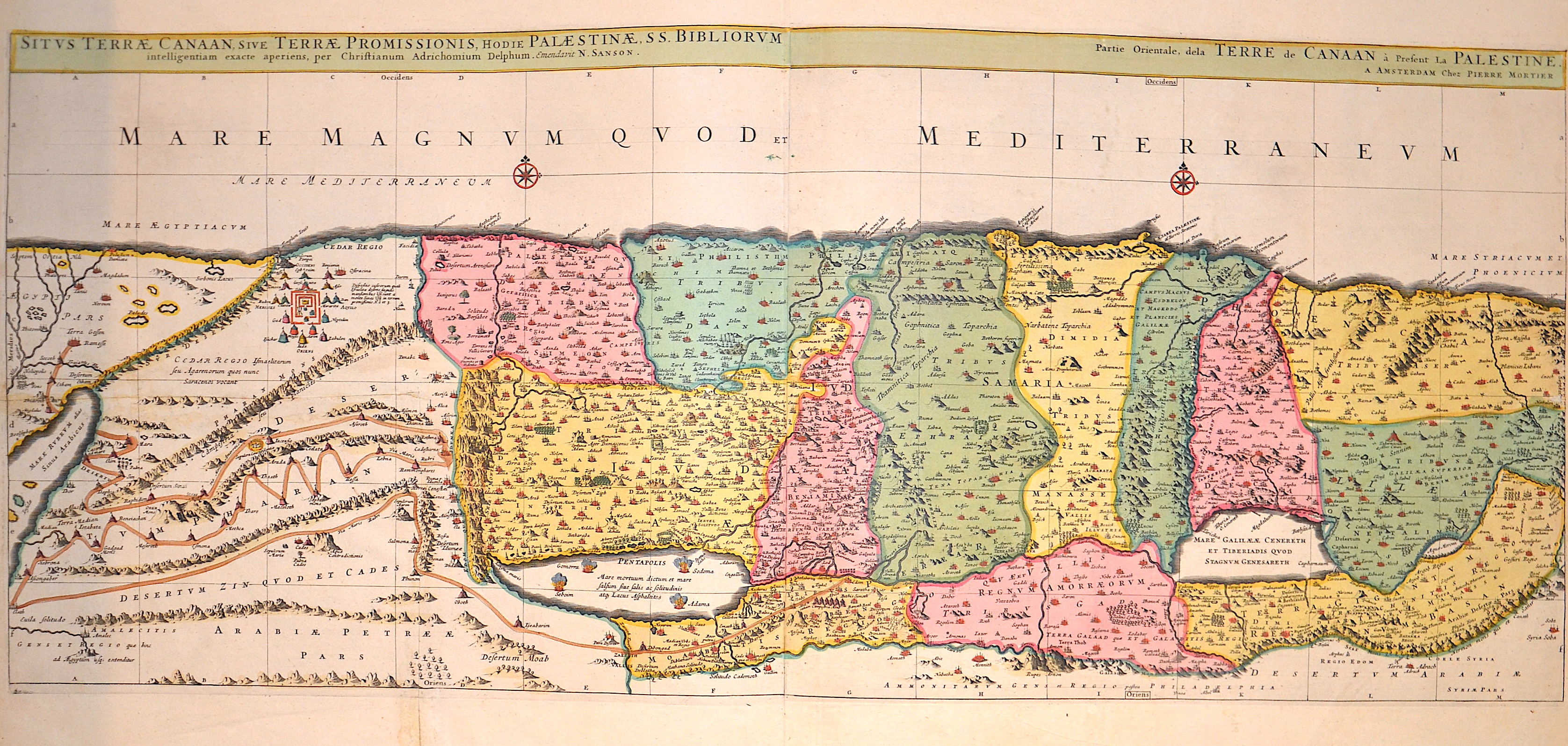
Situs Terrae Canaan, sive Terrae Promissionis, hodie Palaestinae, SS. Bibliorum intelligentiam exacte aperiens, per Christianum Adrichomium Delphum.
| Article ID | ASP1418 |
Title | Situs Terrae Canaan, sive Terrae Promissionis, hodie Palaestinae, SS. Bibliorum intelligentiam exacte aperiens, per Christianum Adrichomium Delphum. |
Sanson based this map of the Holy Land on Christiaan van Adrichom's impressive map, Situs Terrae Promissionis, but with the Mediterranean oriented at the top of the map. The map extends from the Nile Delta to Sidon and is divided into the twelve tribes. There is no bend where Palestine meets Egypt, and the Kishon River erroneously connects the Sea of Galilee with the Mediterranean. With small details that depict numerous biblical scenes, including the Exodus, the wandering of the Children of Israel, and several battle scenes. Two compass roses incorrectly orient north to the top of the map. The map was created by Christiaan van Adrichom (1533–1585) and published by Pieter Mortier as part of the "Atlas Nouveau". | |
| Year | ca. 1708 |
Artist | Sanson/ Mortier, Peter |
| Place of Publication | Amsterdam |
| Dimensions (cm) | 39 x 93 cm |
| Condition | Printed on 2 sheets joined together, 2 folds perfectly restored. |
| Coloring | original colored |
| Technique | Copper print |
:
117.00 €
( A reproduction can be ordered individually on request. )