

Adina Sommer
Antique and Contemporary Art
Winzerer Str. 154
80797 München
telephone
+49 89 304714
business hours:
by appointment
Email
![]()


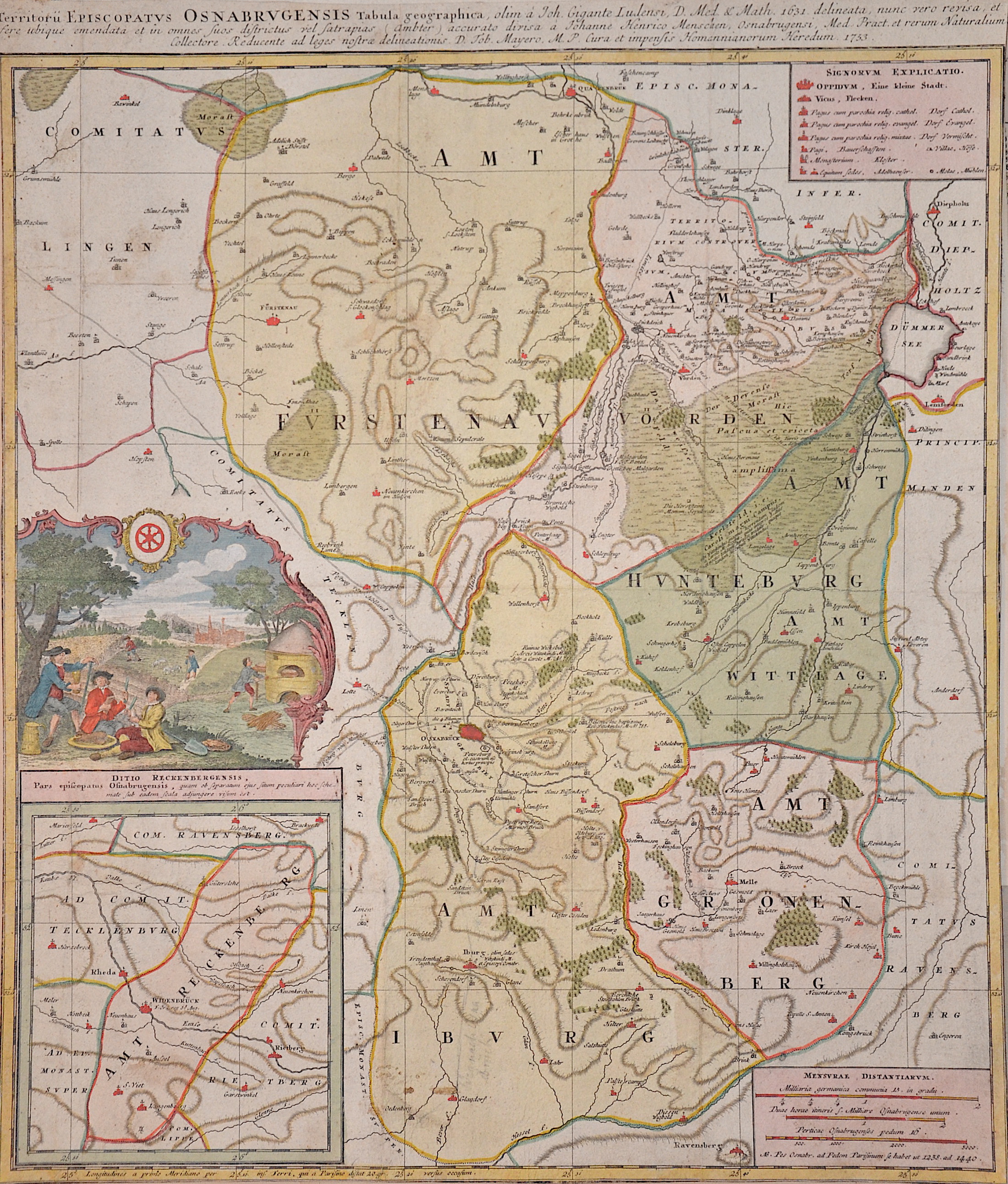
Territorii Episcopatus Osnabrugensis Tabula geographica, olim..
| Article ID | EUD5317 |
Title | Territorii Episcopatus Osnabrugensis Tabula geographica, olim.. |
Map shows part of Lower Saxony with the departments of Fürstenau, Vörden, Hunteburg, Wittlage and Iburg. Also a partial map with the Amt Reckenberg, a mileage scale and a view. | |
| Year | c. 1753 |
Artist | Homann Erben |
| Place of Publication | Nuremberg |
| Dimensions (cm) | 48,5 x 41 cm |
| Condition | Trimmed |
| Coloring | original colored |
| Technique | Copper print |
:
37.50 €
( A reproduction can be ordered individually on request. )