

Adina Sommer
Antique and Contemporary Art
Winzerer Str. 154
80797 München
telephone
+49 89 304714
business hours:
by appointment
Email
![]()


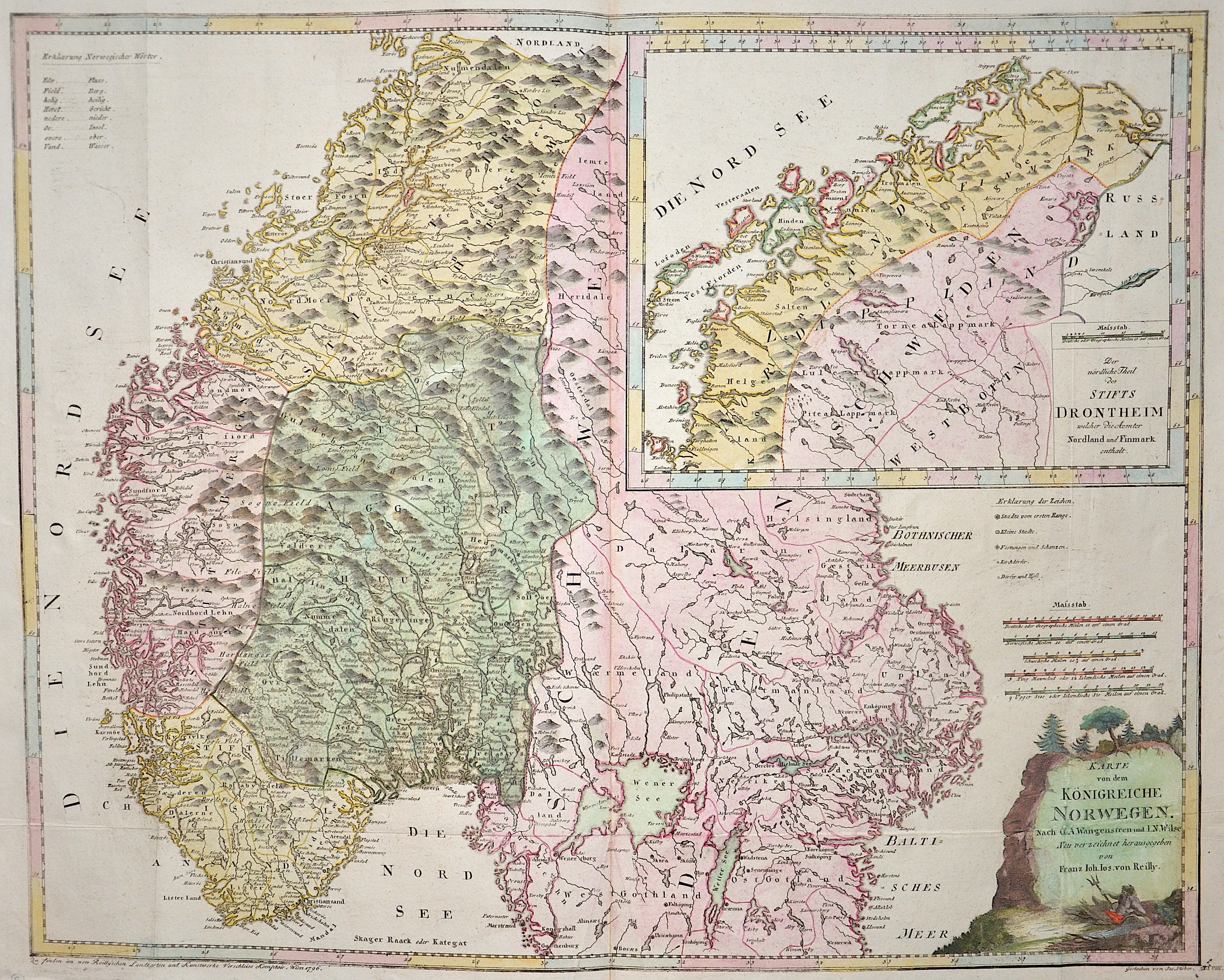
Karte von dem Königreiche Norwegen. Nach O. A. Wangensteen und I. N. Wilse Neu verzeichnet herausgegeben von Franz Joh.Jos. Von Reilly.
| Article ID | EUS5353 |
Title | Karte von dem Königreiche Norwegen. Nach O. A. Wangensteen und I. N. Wilse Neu verzeichnet herausgegeben von Franz Joh.Jos. Von Reilly. |
Map showing Norway, partly Sweden, a inset map of Lapland with the title: "Der nördliche Theil des Stifts Drontheim..." (The northern part of the Diocese of Trondheim...), a title cartouche, and an explanation of Norwegian words in the top left corner. Author: O. A. Wangensteen and I. N. Wilse, engraved in 1796 by Joseph Stöber and published by Franz Joseph von Reilly in his Great German Atlas of 1794–1796. | |
| Year | c. 1796 |
Artist | Reilly |
| Place of Publication | Vienna |
| Dimensions (cm) | 58,5 x 73 cm |
| Condition | Some folds |
| Coloring | original colored |
| Technique | Copper print |
:
66.00 €
( A reproduction can be ordered individually on request. )