

Adina Sommer
Antique and Contemporary Art
Winzerer Str. 154
80797 München
telephone
+49 89 304714
business hours:
by appointment
Email
![]()


Octava Europe Tabula
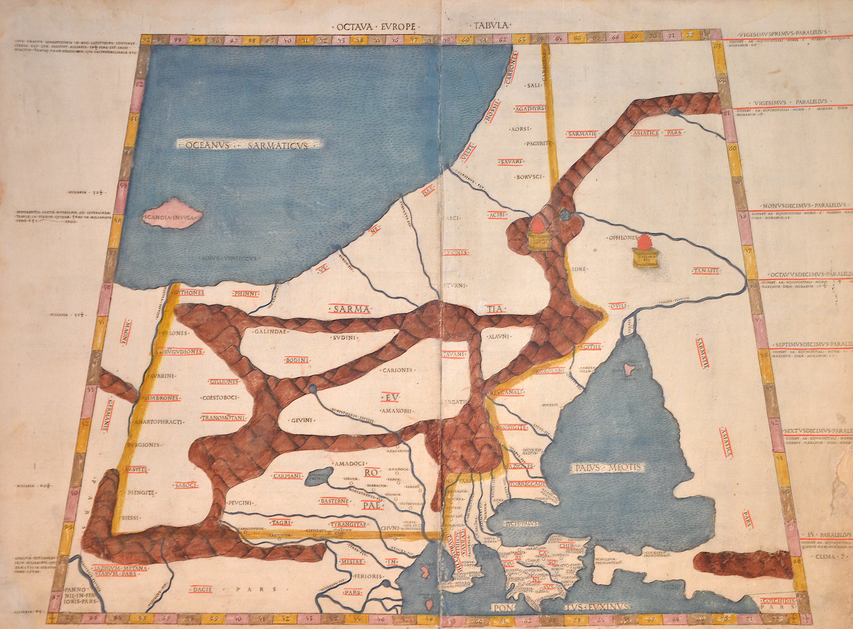
| Article ID | EUO3038 |
Title | Octava Europe Tabula |
Map shows trapezoid the former area of Sarmatia, Russia and Ukrain with the Peninsula Krim and the black sea with the neighbouring countries. Rivers and mountains are roughly shown in the country on the side the climatically zones. Ptolomey watermark on the right side. | |
| Year | ca. 1478 |
Artist | Ptolemy/Conrad Sweynheym |
| Place of Publication | Rome |
| Dimensions (cm) | 37,5 x 53 cm |
| Condition | Perfectly restoration on the outer right margin, printed on two sheet, joined together |
| Coloring | original colored |
| Technique | Woodcut |
:
1,401.00 €
( A reproduction can be ordered individually on request. )