

Adina Sommer
Antique and Contemporary Art
Winzerer Str. 154
80797 München
telephone
+49 89 304714
business hours:
by appointment
Email
![]()


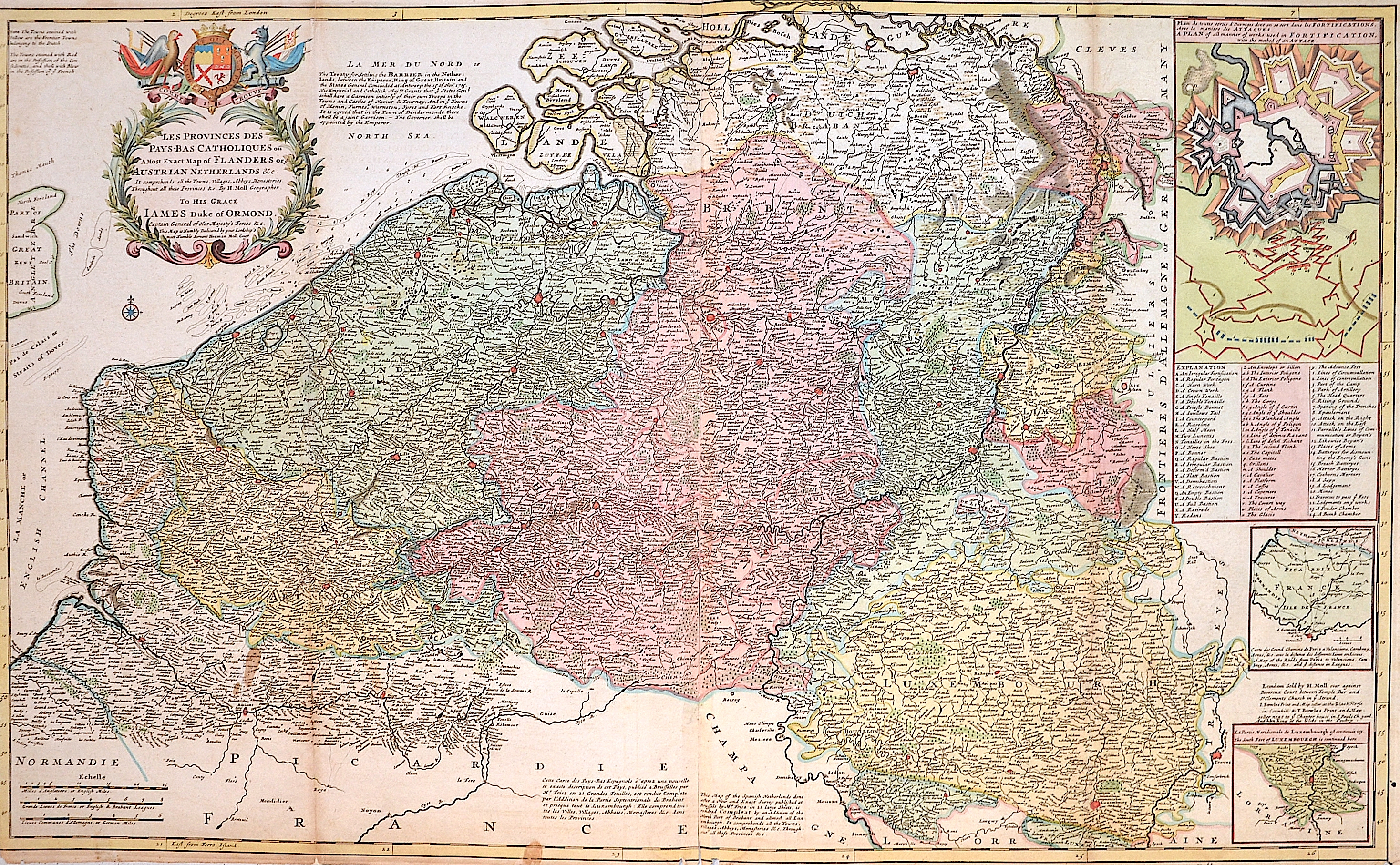
Les Provinces des Pays-Bas Catholiques ou, a most exaxt map of Flanders or Austrian Netherlands und Co.
| Article ID | EUN590 |
Title | Les Provinces des Pays-Bas Catholiques ou, a most exaxt map of Flanders or Austrian Netherlands und Co. |
Map of the Netherlands with splendid title cartouche, coat of arms and three partial maps with a plan of all types of fortifications with the method of attack; A map of the roads from Paris to Valenciennes; The southern part of Luxembourg. The map refers to the Austrian Netherlands. Austria received the Netherlands in the Treaty of Utrecht (signed in 1712). The map is based on the 21-sheet map of the region by Henri Fricx. | |
| Year | ca. 1720 |
Artist | Moll |
| Place of Publication | London |
| Dimensions (cm) | 61 x 100 cm |
| Condition | Some folds partly restored |
| Coloring | original colored |
| Technique | Copper print |
:
118.50 €
( A reproduction can be ordered individually on request. )