

Adina Sommer
Antique and Contemporary Art
Winzerer Str. 154
80797 München
telephone
+49 89 304714
business hours:
by appointment
Email
![]()


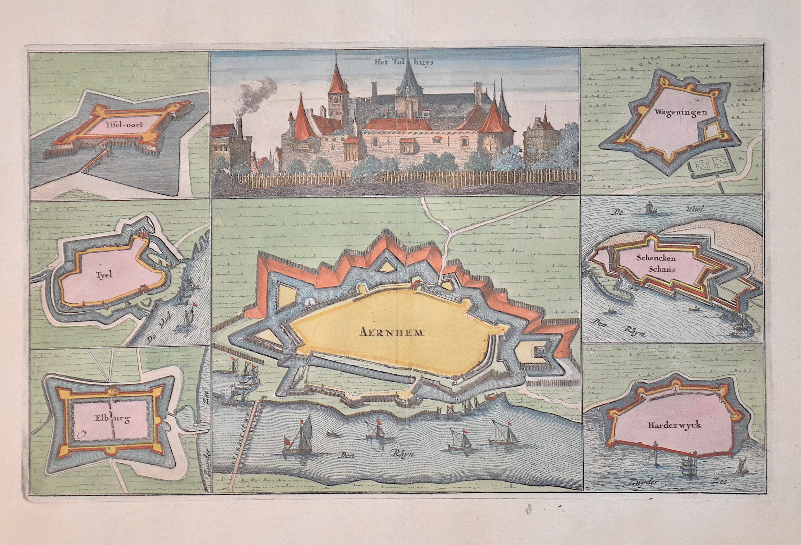
Aernhem / Het Tolhuys
| Article ID | EUN1066 |
Title | Aernhem / Het Tolhuys |
Map shows the city plan of Arnhem and castle view with six fortresses that were taken by the French in 1672 (Üyssel-Oort, Tyel, Elburg, Wgeningen, Schencken, Schanz and Haderwick). Also a view of Het Tolhuis near Lobith, which was burnt down by the French in 1672. Published in ‘Tooneel des Oorlogs’. | |
| Year | ca. 1675 |
Artist | Bosch van den |
| Dimensions (cm) | 18 x 29 cm |
| Condition | Some minor restoration at upper centerfold |
| Coloring | original colored |
| Technique | Copper print |
:
25.50 €
( A reproduction can be ordered individually on request. )