

Adina Sommer
Antique and Contemporary Art
Winzerer Str. 154
80797 München
telephone
+49 89 304714
business hours:
by appointment
Email
![]()


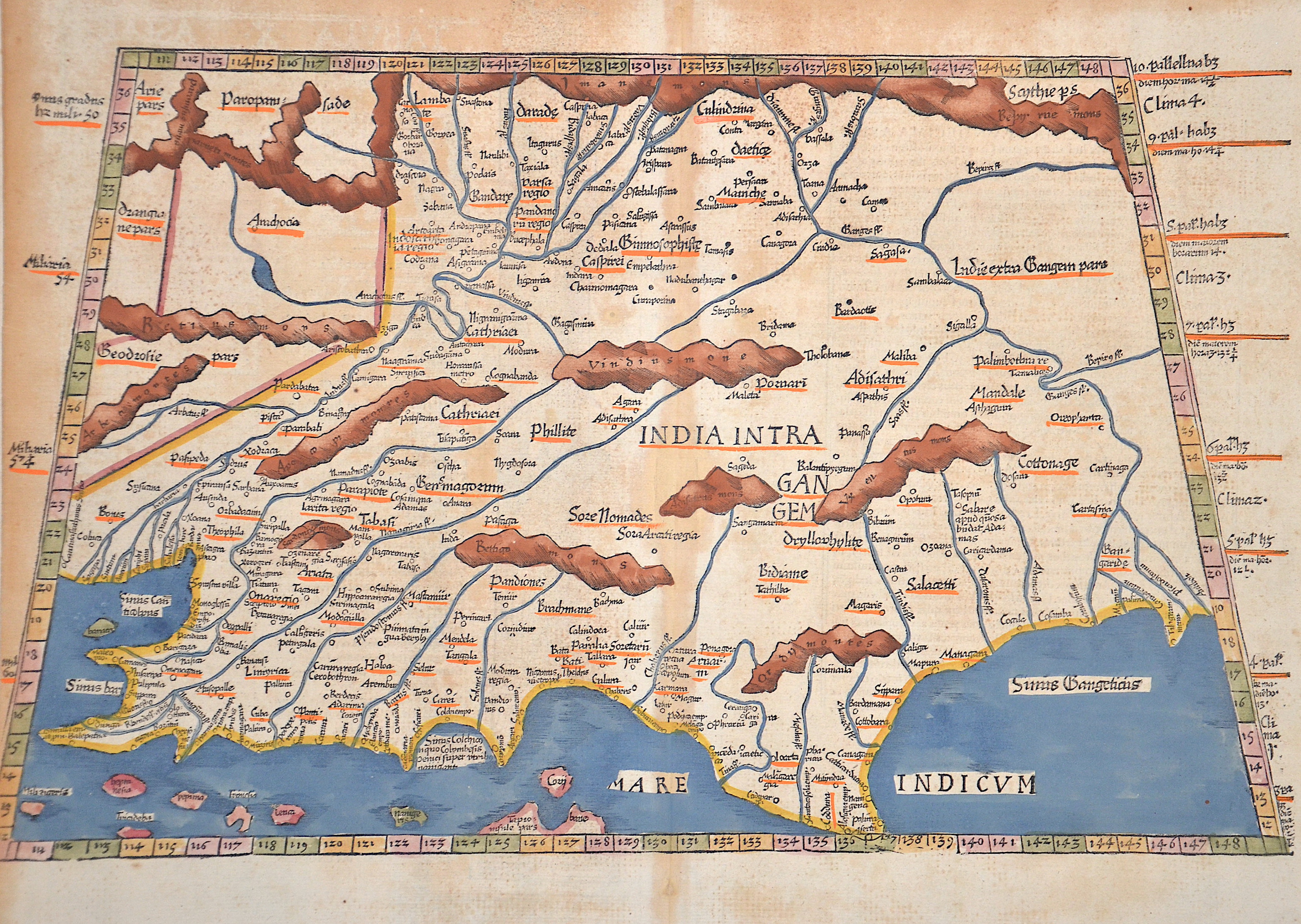
Tabula X Asiae
| Article ID | ASI101 |
Title | Tabula X Asiae |
This is the earliest printed representation of India, west of the Ganges, from the time of Ptolemy. It shows Southwest Asia, including Persia, Afghanistan, Pakistan, and India. Climate and latitude information is provided on the left and right sides. The back features a Latin description, a column representation, and initials. The first edition of this engraving was published in 1522 in the Strasbourg edition of Ptolemy's Geography, followed by further editions in 1525, 1535, and 1541. | |
| Year | ca. 1525 |
Artist | Ptolemy/ Fries |
| Place of Publication | Strassburg |
| Dimensions (cm) | 29,5 x 48 cm |
| Condition | Some Stains |
| Coloring | colored |
| Technique | Woodcut |
:
150.00 €
( A reproduction can be ordered individually on request. )