

Adina Sommer
Antique and Contemporary Art
Winzerer Str. 154
80797 München
telephone
+49 89 304714
business hours:
by appointment
Email
![]()


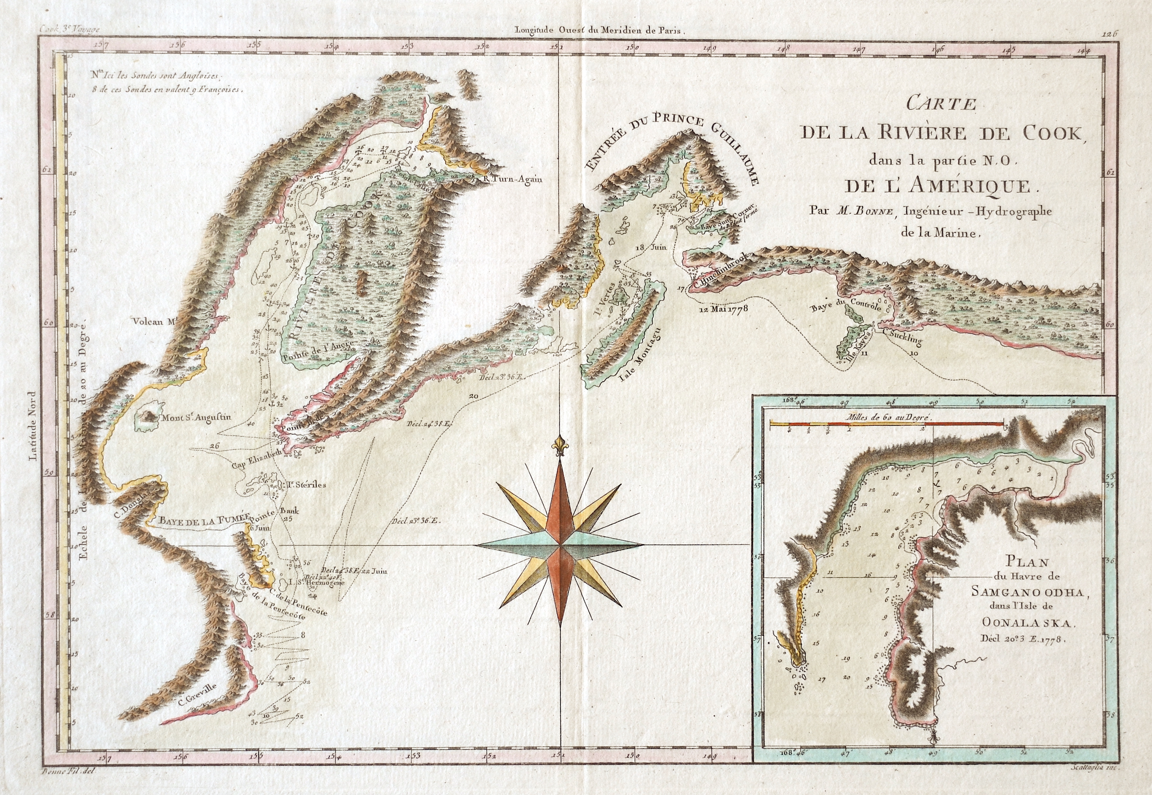
Carte de la River de Cook, dans la partie N.O. de L´Amerique.
| Article ID | AMC1263 |
Title | Carte de la River de Cook, dans la partie N.O. de L´Amerique. |
Map shows the norther coast of Canada with the river Cook and the island Montagu, inset map shows the map of the harbour of Samgano Odha in Alaska. | |
| Year | ca. 1760 |
Artist | Bonne |
| Place of Publication | Paris |
| Dimensions (cm) | 23,5 x 34,5 cm |
| Condition | Perfect condition |
| Coloring | original colored |
| Technique | Copper print |
:
13.50 €
( A reproduction can be ordered individually on request. )