

Adina Sommer
Antique and Contemporary Art
Winzerer Str. 154
80797 München
telephone
+49 89 304714
business hours:
by appointment
Email
![]()


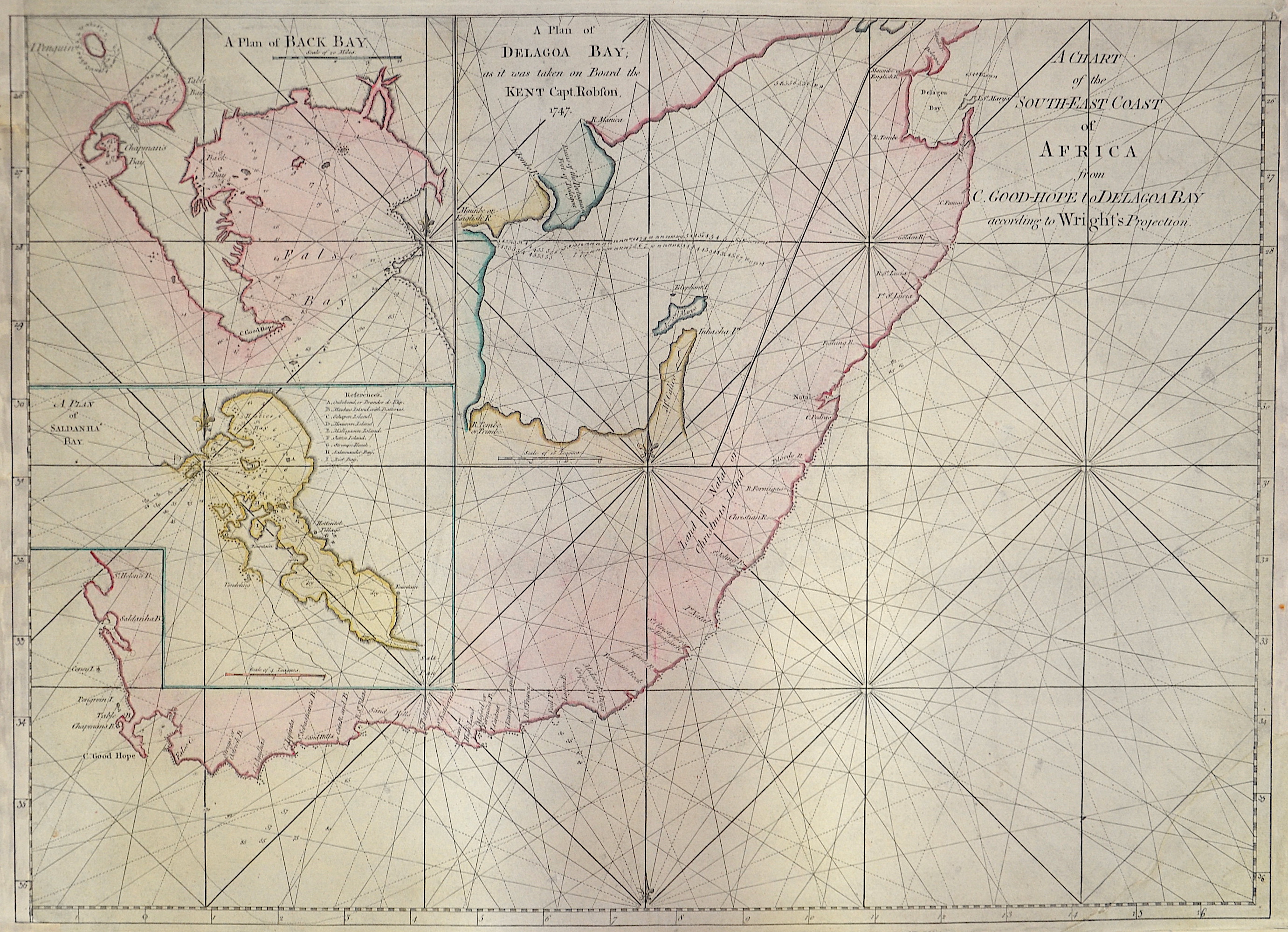
A Chart of the South-East Coast of Africa from C. Good-Hope to Delagoa Bay according to Wright’s Projection.
| Article ID | AF0341 |
Title | A Chart of the South-East Coast of Africa from C. Good-Hope to Delagoa Bay according to Wright’s Projection. |
Decorative sea chart of the south east coast of Africa. 4 maps on one chart:A Plan of Back Bay (Capmans Bay). A Plan of Delagoa Bay as it was taken on Board the Kent Capt (Maputo-Bucht) Robson 1747. A Plan of Saldanha Bay (Südwestküste Afrikas) und der Hauptkarte von der Saldanha Bay über das Kap der Guten Hoffnung bis zur Maputo-Bucht (Delagoa Bay) in Mosambik. | |
| Year | ca. 1750 |
Artist | Anonymus |
| Dimensions (cm) | 45,5 x 63 |
| Condition | Left and right margin replaced, right lower corner replaced |
| Coloring | colored |
| Technique | Copper print |
:
75.00 €
( A reproduction can be ordered individually on request. )