

Adina Sommer
Antique and Contemporary Art
Winzerer Str. 154
80797 München
telephone
+49 89 304714
business hours:
by appointment
Email
![]()


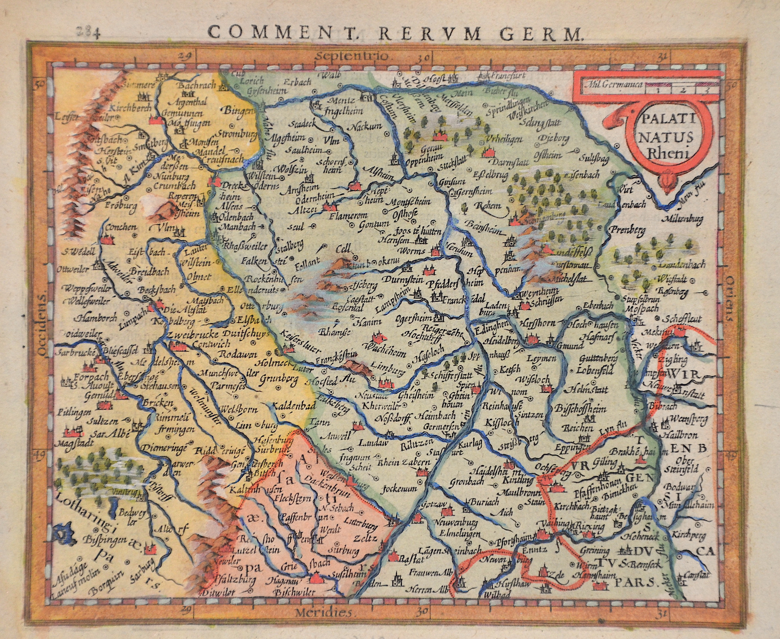
Comment. Rerum Germ. / Palatinatus Rheni 284.

| Article ID | EUD5347 |
Title | Comment. Rerum Germ. / Palatinatus Rheni 284. |
Description | Map shows the course of the Rhine from Bacharach via Mainz, Worms, Rastatt to Baden-Baden and a title cartouche. |
| Year | ca. 1616 |
Artist | Bertius (1565-1629) |
Petrus Bertius (1565 -1629) was a Flemish theologian, historian, geographer and cartographer, He grew up in Beveren (Flanders). In 1593 he was appointed mathematics professor and librarian of the University of Leyden. His main cartographic work includes a miniature world atlas of 1600, a pocket atlas of the German Empire of 1616 with 26 engraved maps and 101 city views, a version of the Geographia of Ptolemy with 28 maps by Mercator and 14 maps from the Parergon of Ortelius of 1618, but he is known today as a cartographer with his edition of the Geographia of Ptolemy (based on Mercator's edition of 1578) and for his atlas. | |
Historical Description | The Rhine is one of the most important rivers in Europe and has played a significant role in the history and development of the region. It connects several countries, including Switzerland, Germany, France, and the Netherlands. In ancient Europe, the Rhine was an important border, separating the Roman Empire from the Germanic tribes to the north. The Romans used the Rhine as a trade and transport route and built several fortresses along the river to secure their border, including the well-known Limes (border fortifications). The Rhine played a central role in the spread of Roman culture and civilization in the areas along the river. In the Middle Ages, the Rhine was not only an important trade route but also a strategic political point. Cities like Cologne, Mainz, and Speyer along the Rhine developed into important commercial centers. The river was a central part of the Holy Roman Empire and played a key role in the political power dynamics of the region. In the late 18th and early 19th centuries, the Rhine underwent profound changes. During the French Revolution and the Napoleonic Wars, the Rhineland came under French control, and after Napoleon's downfall, it was controlled by Prussia and other German states, becoming an important part of the newly formed German Confederation. In the 19th century, the Rhine experienced significant economic transformation. With the expansion of the railway network and industrialization, the river became an important trade route for raw materials such as coal and iron. Cities like Düsseldorf, Leverkusen, and Mannheim experienced enormous growth and became industrial centers that directly benefited from access to the Rhine. Thus, the course of the Rhine has not only geographical significance but also a profound political, cultural, and economic impact that spans thousands of years. It has shaped both conflict and cooperation and remains a key resource for the countries through which it flows. |
| Place of Publication | Amsterdam |
| Dimensions (cm) | 15 x 18 cm |
| Condition | Very good |
| Coloring | colored |
| Technique | Copper print |
Reproduction:
27.00 €
( A reproduction can be ordered individually on request. )