

Adina Sommer
Antique and Contemporary Art
Winzerer Str. 154
80797 München
telephone
+49 89 304714
business hours:
by appointment
Email
![]()


Chart of the Pacific Ocean.
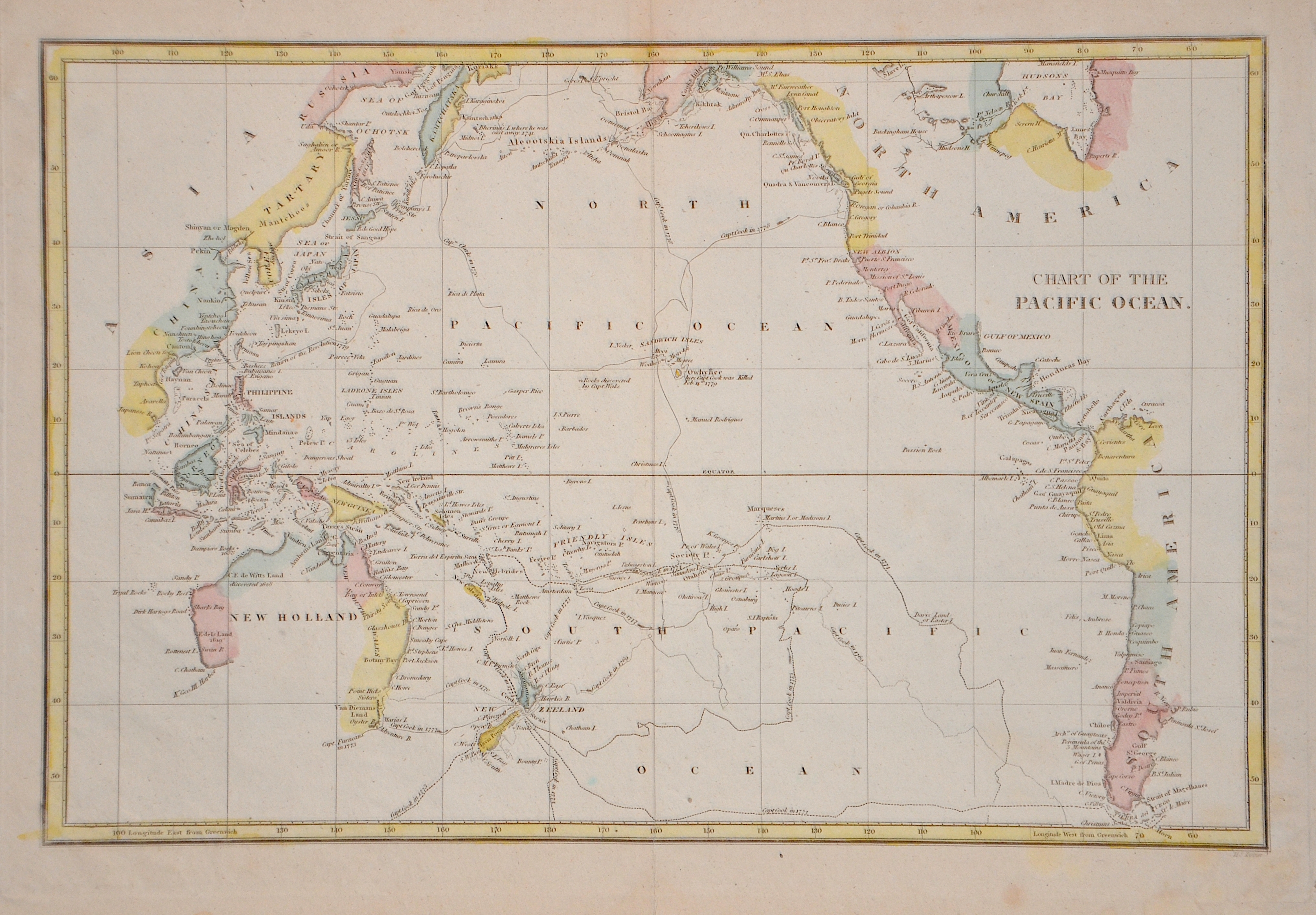

| Article ID | OZ0546 |
Title | Chart of the Pacific Ocean. |
Description | This nautical chart from 1798 shows the routes and dates of the exploration of the Pacific Ocean with the coasts of China, Russia, western Canada, the USA and South America. It also shows South East Asia, Australia, New Zealand, Japan, Kamchatka and Central America. |
| Year | ca. 1798 |
Artist | Arrowsmith (1750-1823) |
Aaron Arrowsmith, born July 14, 1750 in Winston, County Durham, Great Britain; died April 23, 1823 in London, Great Britain. He was an English cartographer, engraver and publisher and founder of the Arrowsmith family of geographers. | |
Historical Description | The history of the Pacific Ocean is closely linked to the discovery and development of trade routes, military conflicts, cultural exchanges, and colonization by various peoples. The Pacific Ocean has been inhabited for thousands of years by indigenous peoples who lived along its coasts and islands. Peoples such as the Polynesians, Micronesians, and Melanesians sailed great distances and settled many of the Pacific islands long before Europeans reached the ocean. In the 16th century, European explorers began to explore the Pacific Ocean. Ferdinand Magellan was the first European to cross the ocean in 1519 when he reached the Pacific after navigating around the southern tip of South America. Other explorers, such as Francisco de Orellana, James Cook, and George Vancouver, contributed to the mapping of the Pacific and its islands. James Cook, a British captain, made several voyages to the Pacific in the 18th century and played a central role in the discovery of New Zealand, Australia, and the Hawaiian Islands. In the 17th and 18th centuries, European powers such as Spain, Britain, France, and the Netherlands began establishing colonies in the Pacific. In the 19th century, European and North American powers began to tap into the economic potential of the Pacific region. The California Gold Rush (1848) and the construction of the Panama Canal (1914) contributed to the increased importance of the Pacific for global trade. Today, the Pacific is a significant economic and geostrategic area. The Pacific Rim includes some of the world’s largest and most dynamic economies, including the United States, China, Japan, South Korea, and Australia. |
| Dimensions (cm) | 23 x 35 cm |
| Condition | Perfect condition |
| Coloring | original colored |
| Technique | Copper print |
Reproduction:
22.50 €
( A reproduction can be ordered individually on request. )