

Adina Sommer
Antique and Contemporary Art
Winzerer Str. 154
80797 München
telephone
+49 89 304714
business hours:
by appointment
Email
![]()


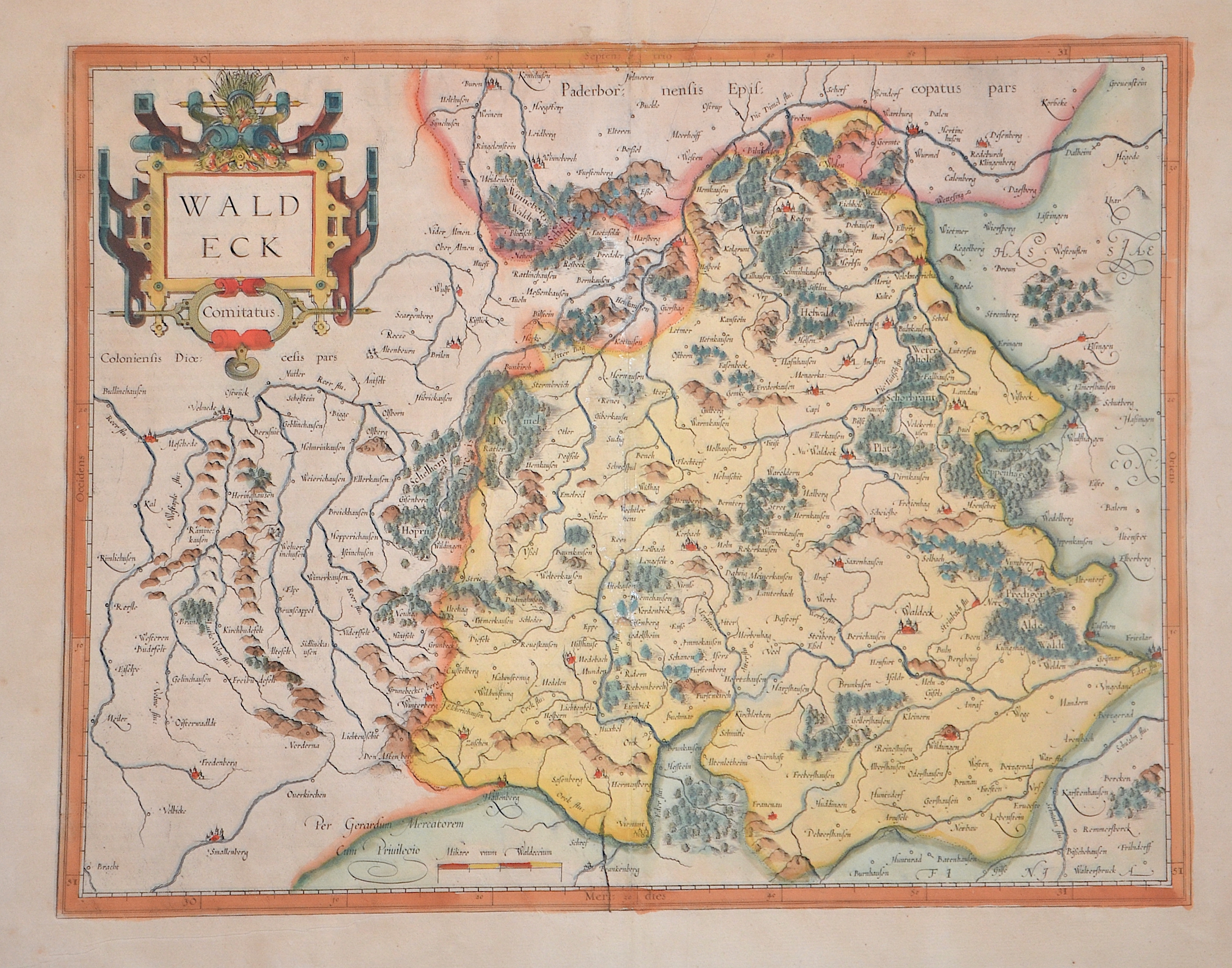
Waldeck Comitatus.

| Article ID | EUD5308 |
Title | Waldeck Comitatus. |
Description | Map shows the surroundings of Waldeck in Hesse with a mileage scale and title cartouche. |
| Year | ca. 1595 |
Artist | Mercator (1512-1594) |
Gerardus Mercator (1512 - 1594). He was a cartographer, philosopher and mathematician. He is best known for his work in cartography, in particular the world map of 1569 based on a new projection which represented sailing courses of constant bearing as straight lines. He is renowned to the present day as the cartographer who created a world map based on a new projection which represented sailing courses of constant bearing as straight lines. In his own day he was the world's most famous geographer but in addition he had interests in theology, philosophy, history, mathematics and magnetism as well as being an accomplished engraver, calligrapher and maker of globes and scientific instruments. He wrote few books but much of his knowledge is to be found in the copious legends on his wall maps and the prefaces that he composed for his atlas ,the first in which the term "atlas" appears and the sections within it. | |
Historical Description | The history of Hessen-Waldeck in the 16th to 19th centuries was shaped by a variety of political upheavals and regional changes, which repeatedly redefined the small principality in the context of larger European events. Waldeck was a small principality in the Holy Roman Empire during the 16th century. It was part of the Electoral Palatinate and was ruled by the princely family of the Counts of Waldeck. At that time, it was predominantly Protestant and played a certain role during the Reformation. In the 17th century, Waldeck was affected by the conflicts of the Thirty Years' War, which devastated the region. The principality suffered from military confrontations and looting, significantly impacting its economic situation. In the 18th century, Waldeck stabilized again, and the principality experienced a phase of relative peace. Waldeck remained an independent principality, ruled by the Princes of Waldeck. Within the framework of the Holy Roman Empire, it remained politically relatively insignificant, but as a small principality, it still played a role in regional affairs. The beginning of the 19th century brought profound changes for Waldeck. In 1806, it joined the Confederation of the Rhine, a coalition under Napoleon's rule. Waldeck was influenced by France and lost some of its sovereignty. After the Congress of Vienna in 1815, Waldeck became part of the German Confederation but remained a sovereign principality. The political structure further changed when Waldeck was annexed by Prussia in the Austro-Prussian War of 1866. Although it became part of Prussia, Waldeck retained a certain degree of autonomy until the end of World War I. After the war, it was transformed into the People's Republic of Waldeck in 1918 and later integrated into the state of Hessen-Waldeck in 1929. |
| Place of Publication | Duisburg |
| Dimensions (cm) | 36 x 46 cm |
| Condition | Restoration at centerfold |
| Coloring | original colored |
| Technique | Copper print |
Reproduction:
48.00 €
( A reproduction can be ordered individually on request. )