

Adina Sommer
Antique and Contemporary Art
Winzerer Str. 154
80797 München
telephone
+49 89 304714
business hours:
by appointment
Email
![]()


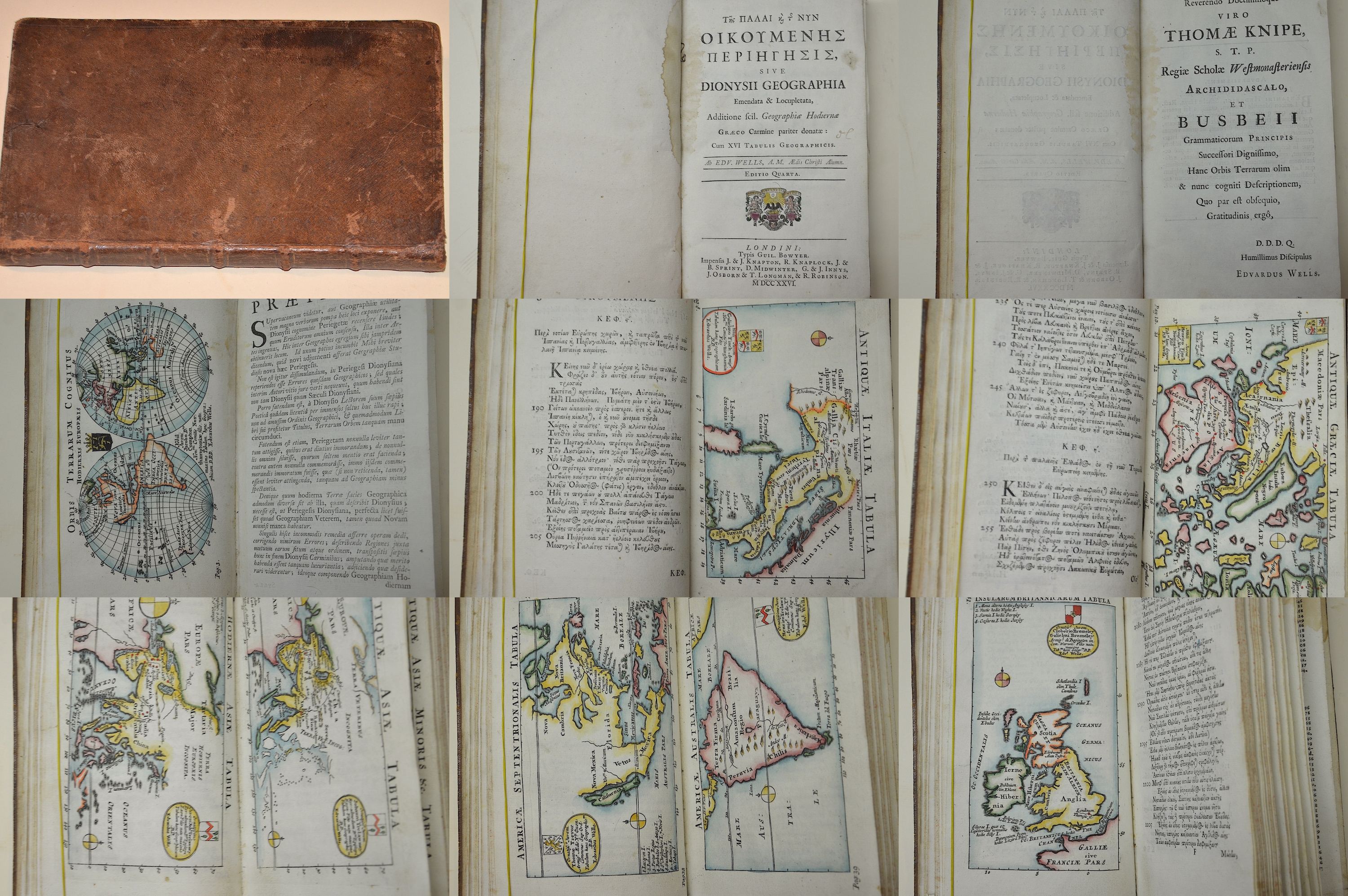
Te s Palai Kai Te s Nyn Oikoumenes Periegesis, sive Dionysii Geographia Emendata u. Locupletata,

| Article ID | B0307 |
Title | Te s Palai Kai Te s Nyn Oikoumenes Periegesis, sive Dionysii Geographia Emendata u. Locupletata, |
Description | Rare school atlas with 16 plates, 2 x the world, Mediterranean map, 2 x Europe, 2 x Italy, Greece, 2 x Africa, 2 x Asia, Asia Minor, North America, South America and Great Britain. On 124 pages, up to p. 50 in Greek then in Latin, index on 8 pages. The first part of the title translated from the Greek. Fourth edition. First and last 10 pages with stains. Author: Dionysius Periegetes and Edward Wells. |
| Year | c. 1726 |
Artist | Wells (1667-1727) |
Edward Wells (1667–1727) was an English mathematician, geographer, and controversial theologian. | |
Historical Description | "Te s Palai Kai Te s Nyn Oikoumenes Periegesis" (Greek) means "The Description of the Ancient and the New Inhabited World." The "Geographia" by Dionysius Periegetes (a Greek geographer from the 2nd century BC) was a poetic description of the known world in ancient Greece, which also included many mythological and cultural aspects. Dionysius' work was an important source for the geographical conception of the time, which was of central importance for both ancient Greece and later the Roman Empire. In Edward Wells' work, the aim was to correct ("emendata") and enrich ("locupletata") the geography of this ancient work by adding more modern geographical insights, maps, and additional information. Wells sought to place the ancient work in the context of the geographical discoveries of his time and make it clearer and more precise for the 18th-century European audience. This work from 1726 is an important geographical publication that represents a correction and expansion of Dionysius Periegetes' ancient "Geographia." It connects the ancient geographical knowledge with the latest discoveries of his time and contributes to the further development of geographical science and cartography. |
| Place of Publication | London |
| Dimensions (cm) | 20 x 12,5 cm |
| Condition | Binding in calfskin |
| Coloring | original colored |
| Technique | Copper print |
Reproduction:
118.50 €
( A reproduction can be ordered individually on request. )