

Adina Sommer
Antique and Contemporary Art
Winzerer Str. 154
80797 München
telephone
+49 89 304714
business hours:
by appointment
Email
![]()


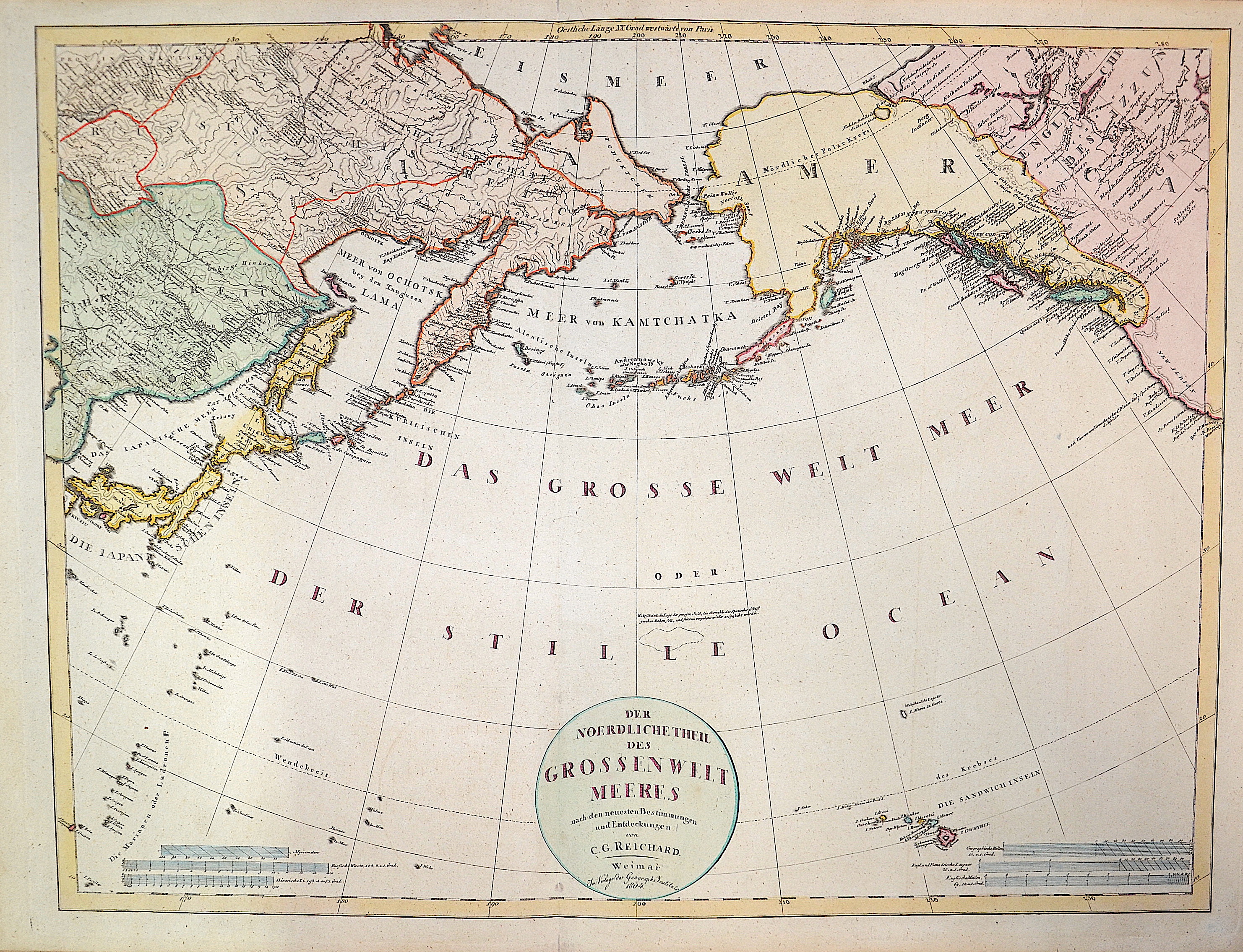
Der Noerdliche Theil des grossen Weltmeeres

| Article ID | SE244 |
Title | Der Noerdliche Theil des grossen Weltmeeres |
Description | Map shows the Behringsea with the Coast of Asia with Japan and the coast of Alaska, map shows also the islands Hawaii |
| Year | dated 1804 |
Artist | Reichard |
Historical Description | The Bering Strait is a strait of the Pacific, which separates Russia and Alaska slightly south of the Arctic Circle. The earliest reference of the strait were from maps from the Polo family; based on the adventures of Marco Polo. From at least 1562, European geographers thought that there was a Strait of Anián between Asia and North America. In 1648, Semyon Dezhnyov probably passed through the strait, but his report did not reach Europe. Danish-born Russian navigator Vitus Bering entered it in 1728. In 1732, Mikhail Gvozdev crossed it for the first time, from Asia to America. |
| Place of Publication | Weimar |
| Dimensions (cm) | 50 x 66 |
| Condition | Very good |
| Coloring | colored |
| Technique | Copper print |
Reproduction:
61.50 €
( A reproduction can be ordered individually on request. )