

Adina Sommer
Antique and Contemporary Art
Winzerer Str. 154
80797 München
telephone
+49 89 304714
business hours:
by appointment
Email
![]()


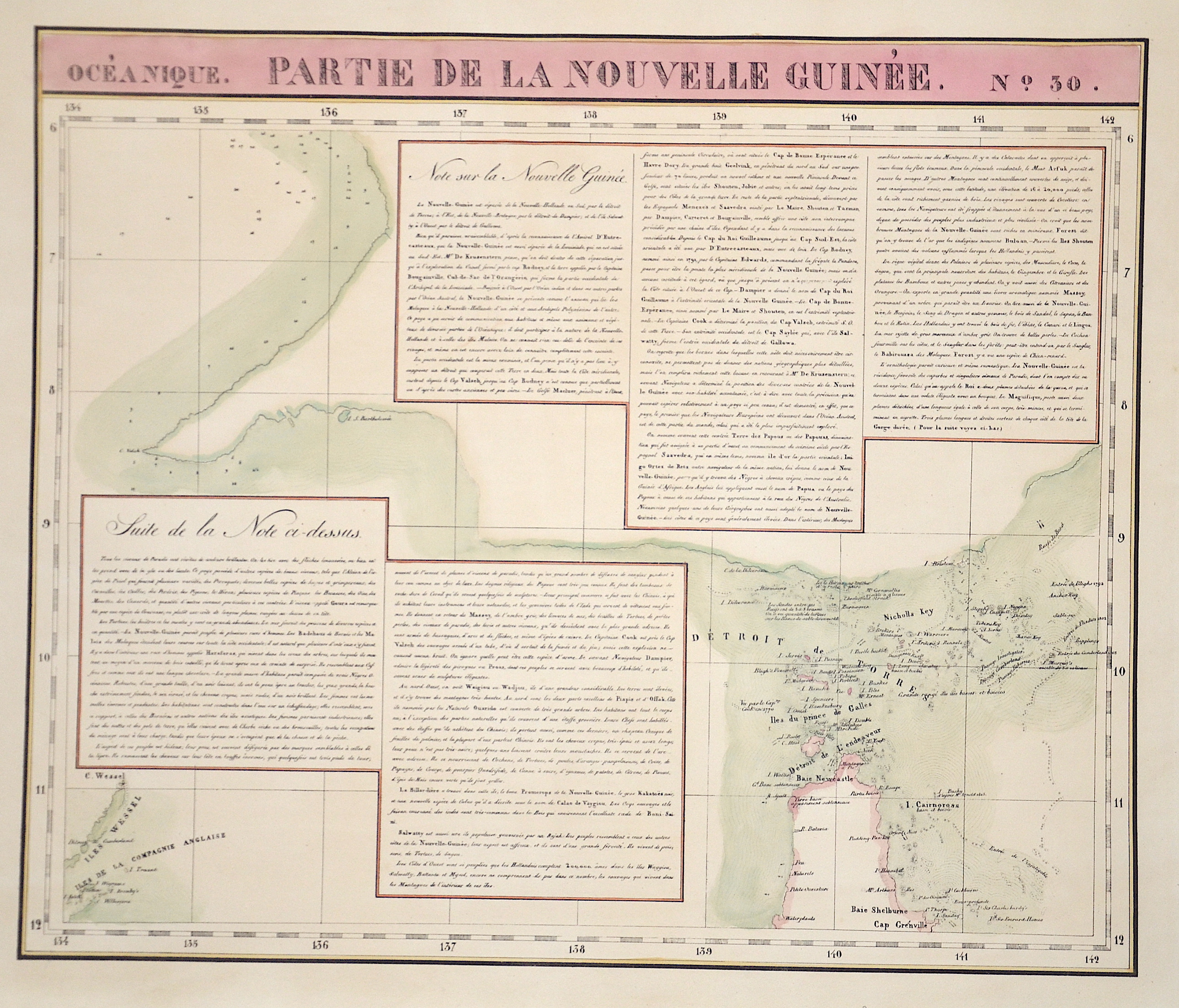
Partie de la nouvelle Guinée No. 30

| Article ID | OZ0342 |
Title | Partie de la nouvelle Guinée No. 30 |
Description | Map shows the Detroit de Torres between Australia and Papua- New Guinea |
| Year | ca. 1825 |
Artist | Vandermaelen |
Historical Description | Independent State of Papua New Guinea, is an oceanic country that occupies the eastern half of the island of New Guinea and its offshore islands in Melanesia, a region of the southwestern Pacific Ocean north of Australia. The Portuguese Jorge de Meneses, who explored the north coast and offshore islands in 1526/27, is considered the island's European explorer. In 1545 the Spaniard Íñigo Ortiz de Retez landed and named the island "New Guinea" because the coast reminded him of that of the African Guinea, which he had previously passed. In 1623 Jan Carstenszoon mapped large parts of the coast on behalf of the Dutch East India Company. Since then, the Dutch East India Company has maintained business and political contacts with the region and the Sultanate of Tidore. |
| Place of Publication | Bruxelles |
| Dimensions (cm) | 47 x 56 |
| Condition | Very good |
| Coloring | original colored |
| Technique | Lithography |
Reproduction:
30.00 €
( A reproduction can be ordered individually on request. )