

Adina Sommer
Antique and Contemporary Art
Winzerer Str. 154
80797 München
telephone
+49 89 304714
business hours:
by appointment
Email
![]()


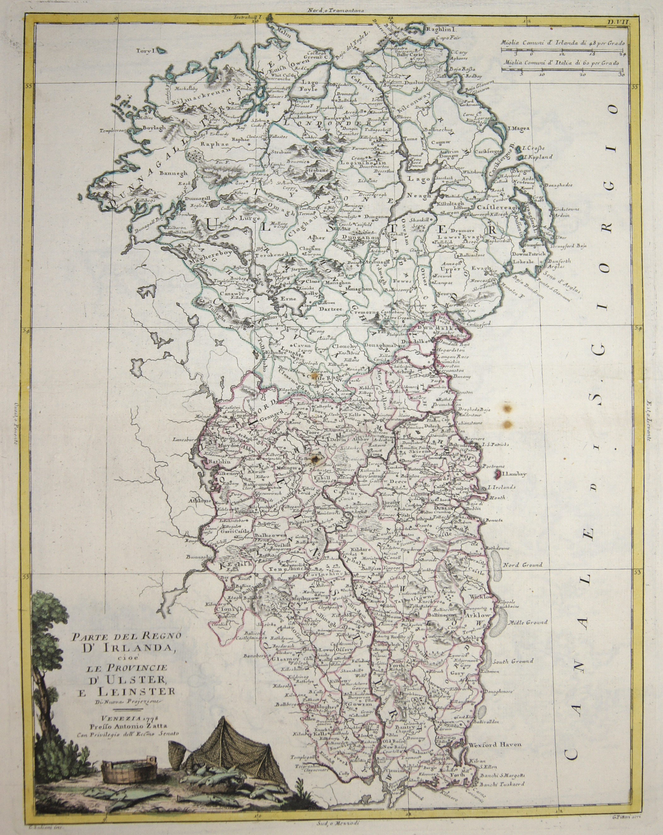
Parte del Regno d’Irlanda, cioè le Provincie d’ Ulster, e Leinster

| Article ID | EUG3730 |
Title | Parte del Regno d’Irlanda, cioè le Provincie d’ Ulster, e Leinster |
Description | Map shows Ulster und Leinster, a region in the formaer province of Oreland with the cities of Ballyshannon, Coleraine, Ballycastle, Ballymena, Carrickfergus, Bangor, Downpatrick, Newcastle, Newry, Dundalk, Dublin, Arklow, Wexford, etc, a decorative title cartouche. |
| Year | dated 1778 |
Artist | Zatta (1757-1797) |
Antonio Zatta (1757 – 1797) was an Italian cartographer who was based in Venice. One of his major contributions include the Atlante Novissimo, a four volume atlas of the world in very high scientific quality. | |
Historical Description | In the Roman Empire, Ireland was known as Hiberna, the classical latin name. The Norman invasion of the late 12th century marked the beginning of more than 800 years of direct English rule and, later, British involvement in Ireland. Attempts to either conquer or assimilate the Irish lordships into the Kingdom of Ireland provided the initial impetus for a series of Irish military campaigns between 1534 and 1603. This period was marked by a Crown policy of plantation, involving the arrival of thousands of English and ScottishProtestant settlers, and the consequent displacement of the pre-plantation Catholic landholders. As the military and political defeat of Gaelic Ireland became more pronounced in the early seventeenth century, sectarian conflict became a recurrent theme in Irish history. |
| Place of Publication | Venice |
| Dimensions (cm) | 41 x 31,5 |
| Condition | Perfect condition |
| Coloring | original colored |
| Technique | Copper print |
Reproduction:
39.00 €
( A reproduction can be ordered individually on request. )