

Adina Sommer
Antique and Contemporary Art
Winzerer Str. 154
80797 München
telephone
+49 89 304714
business hours:
by appointment
Email
![]()


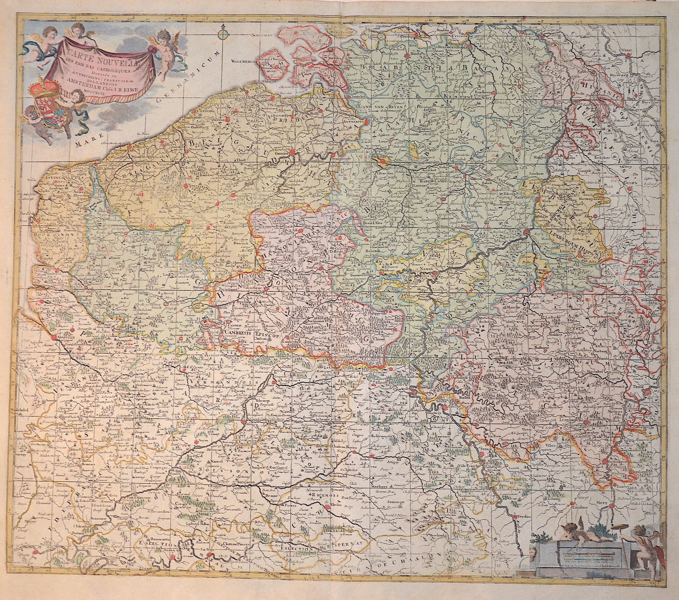
Carte nouvelle des Pais bas Catholiques

| Article ID | EUB2803 |
Title | Carte nouvelle des Pais bas Catholiques |
Description | The ‘New Map of the Catholic Netherlands’ shows today's entire Belgium, Luxembourg and partly the Netherlands with e.g. Breda and Maastrich. Furthermore, a title cartouche held by three putti and the coat of arms of the Spanish Netherlands, at the bottom right a mileage cartouche with two putti. |
| Year | dated 1792 |
Artist | Elwe (1777-1777) |
Jan Barend Elwe ( 177 - 1815), was a Dutch publisher and book seller who reissued maps by De L´Isle and Ottens and some other cartographers in the late 18th century. His famous map "Amerique Septentrionale Divisee en ses Principales Parties" was derived mainly from Sanson’s and Jaillot’s maps of 1656 and 1676. At this time, California was no longer shown as an island, but as a peninsular, and the Great Lakes to the north are enclosed, which was another feature often shown incorrectly on earlier maps of America. This map has been published in 1792 in an Atlas which included 37 other maps of different countries. | |
Historical Description | The area, which later includes the Benelux area, is called de Lage Landen in Dutch, Low Countries in English, consisting of Belgium, the Netherlands (Nederland) and Luxembourg. In the 19th century, three countries were united under the crown of the Dutch king from 1815 to 1830, until Belgium became independent. The forerunners of the Benelux Treaty were the economic union concluded between Luxembourg and Belgium on July 25, 1921. |
| Place of Publication | Amsterdam |
| Dimensions (cm) | 52 x 60 cm |
| Condition | Perfect condition |
| Coloring | original colored |
| Technique | Copper print |
Reproduction:
48.00 €
( A reproduction can be ordered individually on request. )