

Adina Sommer
Antique and Contemporary Art
Winzerer Str. 154
80797 München
telephone
+49 89 304714
business hours:
by appointment
Email
![]()


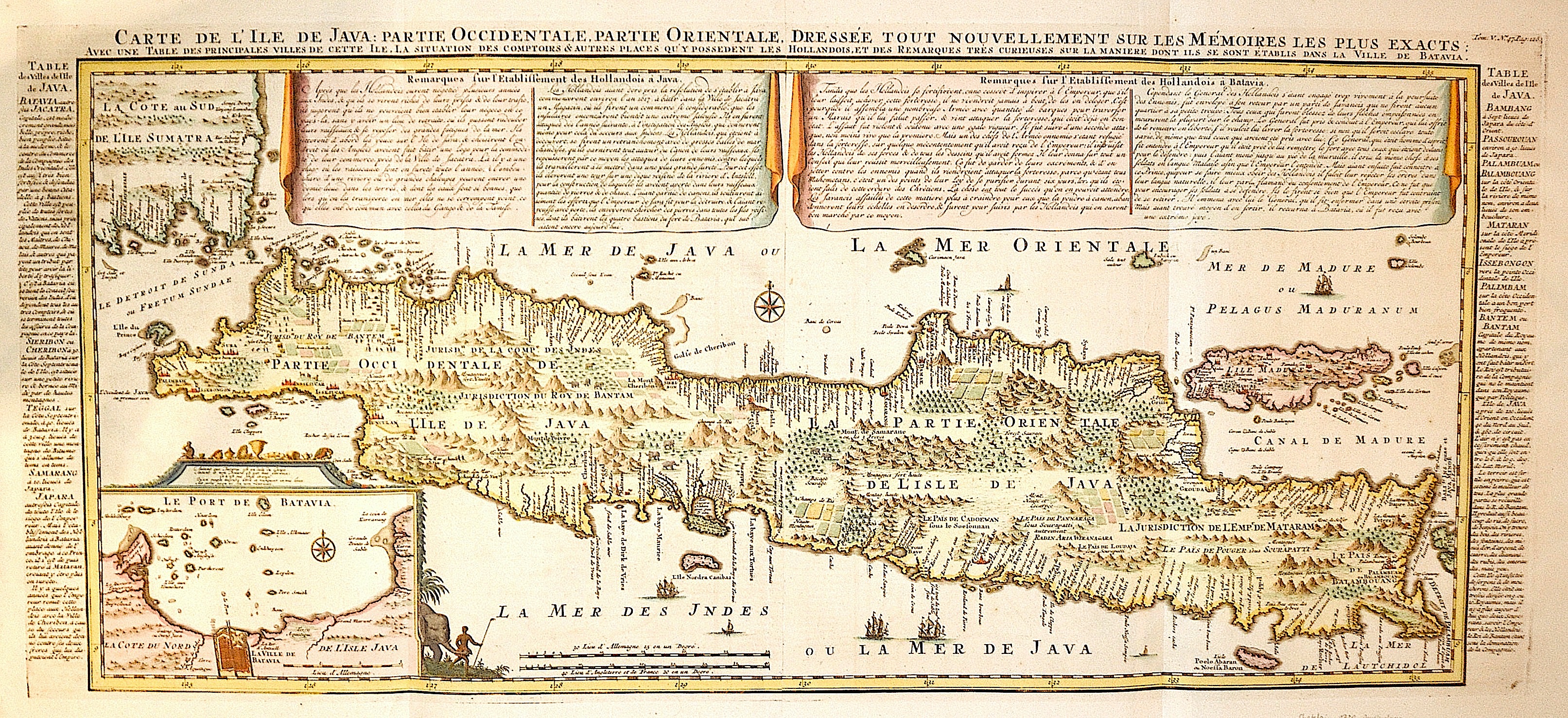
Carte de l´Ile de Java: Partie occidentale, partie oreintale, dresse tout nouvellement sur les memoires les plus exactes

| Article ID | ASS313 |
Title | Carte de l´Ile de Java: Partie occidentale, partie oreintale, dresse tout nouvellement sur les memoires les plus exactes |
Description | Map shows the Island Java with insert map of the harbour of Batavia. |
| Year | ca. 1720 |
Artist | Chatelain (1684-1743) |
Henri Abraham Chatelain (1684 - 1743) was a Huguenot pastor of Parisian origins. He lived consecutively in Paris, St. Martins, London (c. 1710), The Hague (c. 1721) and Amsterdam (c. 1728). He is best known as a Dutch cartographer and more specifically for his cartographic contribution in the seminal seven volume Atlas Historique, published in Amsterdam between 1705 and 1720. Innovative for its time, the Atlas Historique combined fine engraving and artwork with scholarly studies of geography, history, ethnology, heraldry, and cosmography. Some scholarship suggests that the Atlas Historique was not exclusively compiled by Henri Chatelain, as is commonly believed, but rather was a family enterprise involving Henri, his father Zacharie and his brother, also Zacharie. | |
| Place of Publication | Amsterdam |
| Dimensions (cm) | 38 x 87 |
| Condition | Very good |
| Coloring | colored |
| Technique | Copper print |
Reproduction:
204.00 €
( A reproduction can be ordered individually on request. )