

Adina Sommer
Antique and Contemporary Art
Winzerer Str. 154
80797 München
telephone
+49 89 304714
business hours:
by appointment
Email
![]()


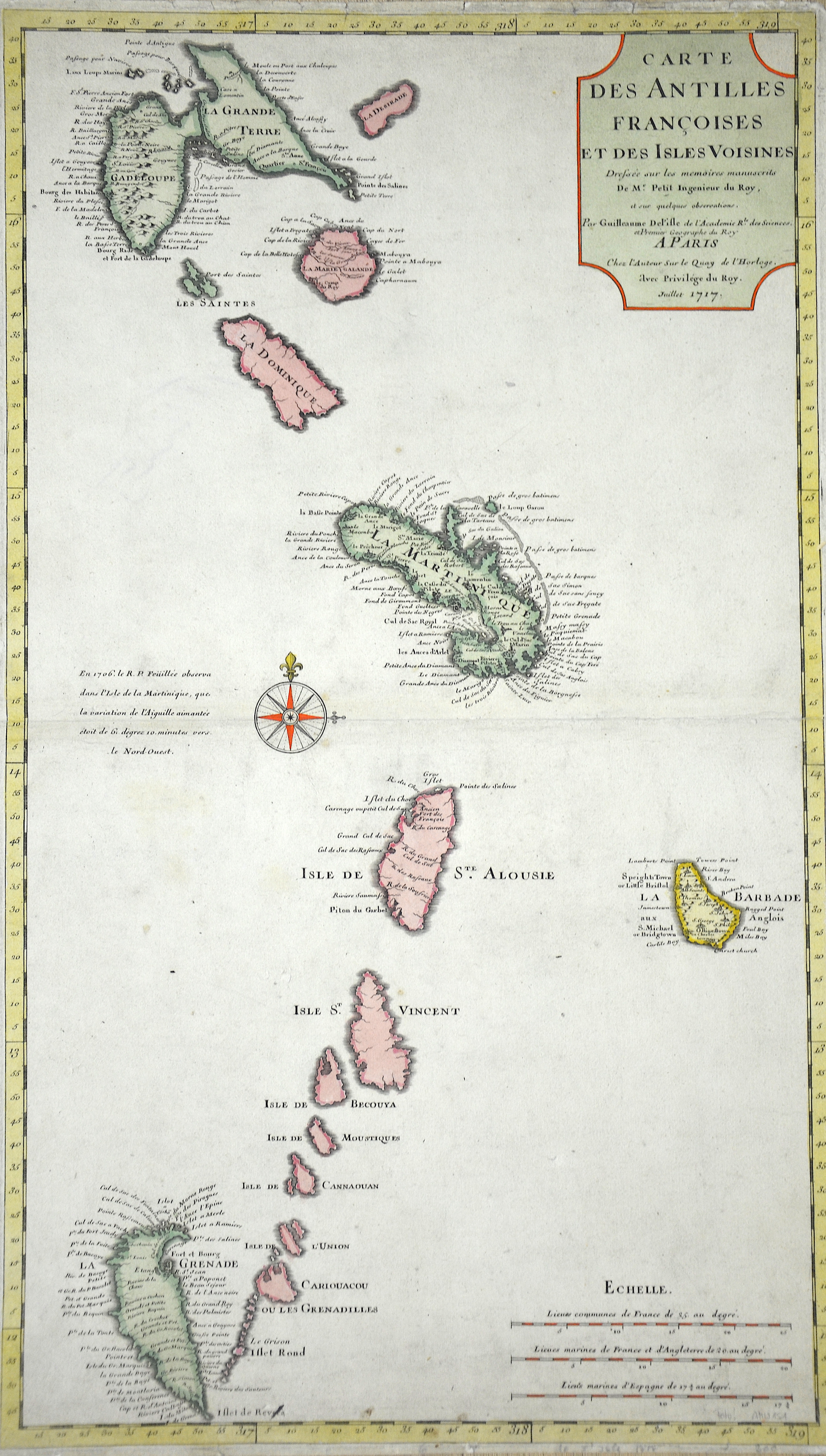
Carte des Antilles Francoises et des Isles Voisines…

| Article ID | AMW151 |
Title | Carte des Antilles Francoises et des Isles Voisines… |
Description | Map of the Lower Antilles, from Guadeloupe to Grenada. |
| Year | dated 1717 |
Artist | L´Isle, de /Covens & Mortier (1675-1726) |
Guillaume De L´isle (1675- 1726) Paris, was a French cartographer known for his popular and accurate maps of Europe and the newly explored Americas and Africa. De L´isle was admitted into the French Académie Royale des Sciences, an institution financed by the French state. After that date, he signed his maps with the title of “Géographe de l’Académie”. Five years later, he moved to the Quai de l’Horloge in Paris, a true publishing hub where his business prospered. De L´isle’s ascension through the ranks culminated in 1718 when he received the title of Premier Géographe du Roi. His new office consisted in teaching geography to the Dauphin, King Louis XIV’s son, a task for which he received a salary. De L´sle’s reputation as a man of science probably helped .This supports the claim of the historian Mary Sponberg Pedley, who says “once authority was established, a geographer’s name might retain enough value to support two or three generations of mapmakers”. In De L´isle’s case, it could be said that his accomplishments surpassed his father’s. Up to that point, he had drawn maps not only of European countries, such as Italy, Spain, Germany, Great Britain, Poland, and regions such as the Duchy of Burgundy, but he had also contributed to the empire’s claims to recently explored continents of Africa and the Americas. Like many cartographers of these days, De L´isle did not travel with the explorers and elaborated the maps mostly in his office. The quality of his maps depended on a solid network that would provide him first-hand information. Given the family’s reputation and his own, De L´isle had access to fairly recent accounts of travellers who were coming back from the New World, which gave him an advantage over his competitors. Being a member of the Académie, he was also aware of recent discoveries, especially in astronomy and measurement. When he could not confirm the accuracy of his source, he would indicate it clearly on his maps. For instance, his Carte de la Louisiane shows a river that the baron of Lahontan claimed he discovered, but no one else could validate it, so Delisle warned the viewer that its actual existence was in doubt. De L´isle 's search for exactitude and intellectual honesty entangled him in a legal dispute in 1700 with Jean-Baptiste Nolin, a fellow cartographer. Noticing Nolin had used details that were considered original from his Map of the World, De L´isle dragged Nolin in court to prove his plagiarism. In the end, Delisle managed to convince the jury of scientists that Nolin only knew the old methods of cartography and therefore that he had stolen the information from his manuscript. Nolin's maps were confiscated and he was forced to pay the court costs.The scientificity of the work produced by the De L´isle family contrasted with the workshop of Sanson. While Sanson knowingly published outdated facts and mistakes, De L´isle strived to present up-to-date knowledge. | |
Historical Description | Saint-Martin. They are part of the Lesser Antilles. The first inhabitants of the Caribbean, the Arawaks, came from South America and the oldest archaeological evidence of human life dates from 3500 to 3000 B.C. These excellent fighters and skillful sailors populated the Caribbean at the time when Cristoph Columbus dropped anchor off Guadeloupe in 1493 and off Martinique in 1502. The examples of primitive art at the “Roches Gravés” (rock engravings) sites date back to this pre-Columbian era. The American-Indian Museum of Early History also impressively documents this era. Reconstructions of plantations on Martinique or the archaeological site of a slave house on Guadeloupe remind us that slavery was introduced in the Antilles in 1685 with the “Code Noir”. The economy was based almost entirely on specialized agriculture on a large scale: sugar cane, coffee and cocoa, which later gave way to banana cultivation. It was not until 1635 that the French succeeded in colonizing Guadeloupe, for example. In 1664, the island was transferred to the French West India Company. After its dissolution in 1674, the French crown took over the administration of the colony, with a governor at the head. At the end of the 18th century, numerous uprisings by slaves, free people of color, white planters and merchants shook France's Caribbean colonies. In the shadow of the great slave revolt of Saint-Domingue, the French colonies in the Lesser Antilles, the îles du vent - Martinique, Guadeloupe and Ste.-Lucie - were also affected by the revolutionary upheavals. In the course of the French Revolution of 1789, slavery was abolished in the French colonies and thus also in Guadeloupe in February 1794. Great Britain took advantage of the new political situation and occupied the islands in April 1794. Plantation owners feared the implementation of the declared abolition of slavery and supported the British occupation, but the French expelled the British in June 1794. Napoleon Bonaparte reintroduced slavery in the French colonies in 1802. During the Napoleonic Wars, Great Britain re-conquered Guadeloupe in February 1810. In the Peace of Paris, Sweden returned the island to France in 1814 in exchange for 24 million francs. |
| Place of Publication | Paris |
| Dimensions (cm) | 65 x 38 |
| Condition | Very good |
| Coloring | colored |
| Technique | Copper print |
Reproduction:
39.00 €
( A reproduction can be ordered individually on request. )