

Adina Sommer
Antique and Contemporary Art
Winzerer Str. 154
80797 München
telephone
+49 89 304714
business hours:
by appointment
Email
![]()


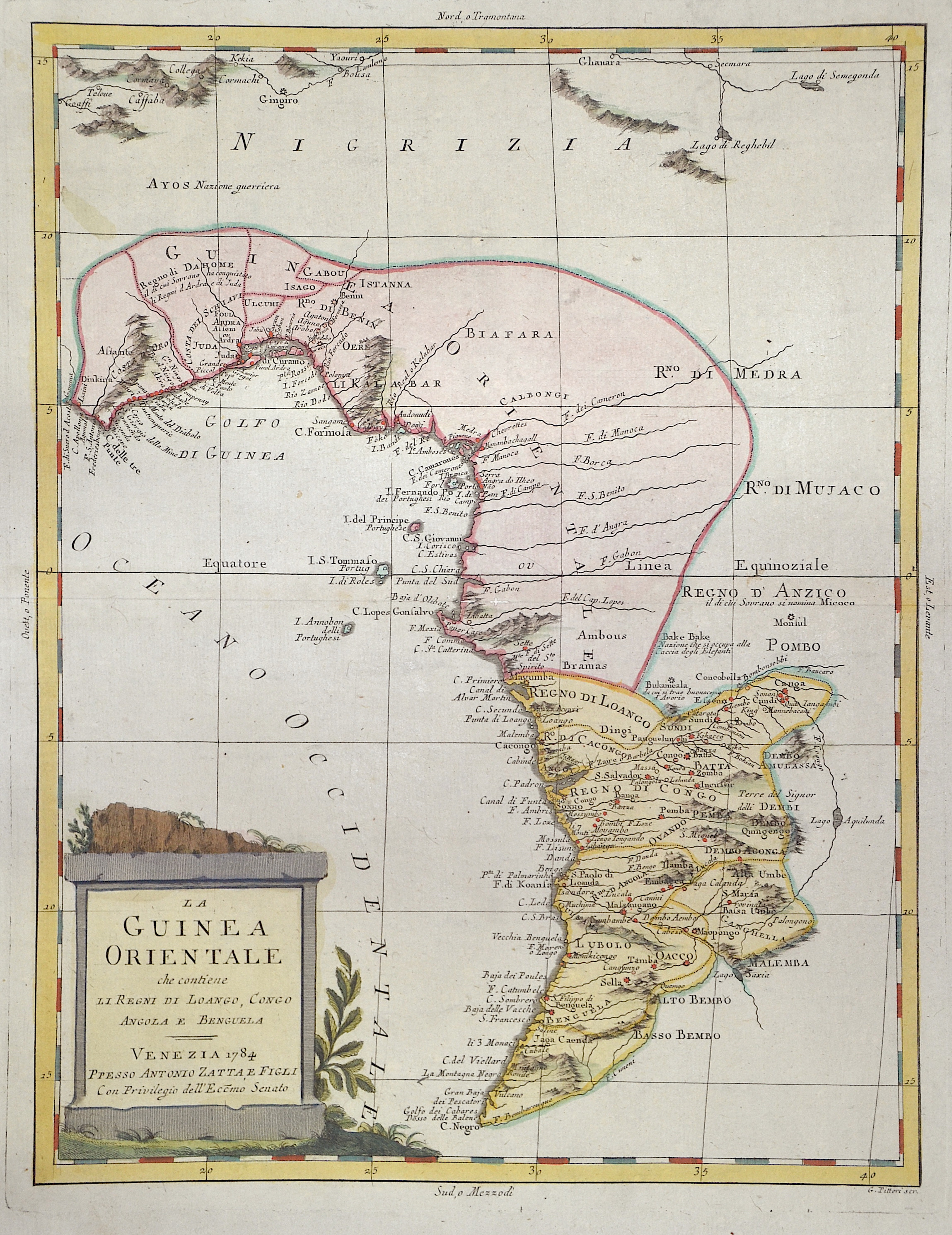
La Guinea Orientale che contiene li Regni di Loango, Congo Angola e Benguela

| Article ID | AF0537 |
Title | La Guinea Orientale che contiene li Regni di Loango, Congo Angola e Benguela |
Description | Map shows the south-west coast with Cameroon, Gabon, up to the town of Pointe-Noire in the Congo and a title cartouche. |
| Year | c. 1784 |
Artist | Zatta (1757-1797) |
Antonio Zatta (1757 – 1797) was an Italian cartographer who was based in Venice. One of his major contributions include the Atlante Novissimo, a four volume atlas of the world in very high scientific quality. | |
Historical Description | The name Gabon is derived from the Portuguese word "Gabão" and means "cloak". When Portuguese sailors reached the country's coast in the 15th century, they gave the name Gabão to the mouth of the Komo River because of its peculiar shape. After settling the area, the French settlers gained a first sovereignty over the territory in 1839. In 1854 Gabon was united with Gorée and other French settlements, and Gorée was reincorporated into Senegal in 1858. In 1888 Gabon became part of French Congo, and in 1910 it was separated again as an independent part of French Equatorial Africa. When French Equatorial Africa was dissolved in 1958, Gabon gained autonomy as the Gabonese Republic. Rich natural resources and a liberal economic policy favored Gabon's economic development. Gabon is thus one of the richest countries in sub-Saharan Africa. |
| Place of Publication | Venice |
| Dimensions (cm) | 41 x 32 cm |
| Condition | Perfect condition |
| Coloring | original colored |
| Technique | Copper print |
Reproduction:
45.00 €
( A reproduction can be ordered individually on request. )