

Adina Sommer
Antique and Contemporary Art
Winzerer Str. 154
80797 München
telephone
+49 89 304714
business hours:
by appointment
Email
![]()


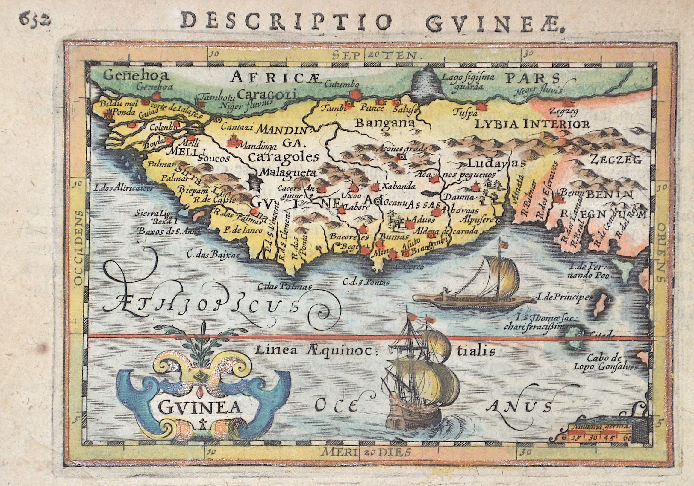
Descriptio Gunieae. / Guinea

| Article ID | AF0532 |
Title | Descriptio Gunieae. / Guinea |
Description | Map shows the Gulf of Guinea with the countries Guinea, Sierra Leone, Liberia, Ivory Coast, Ghana, Togo, Benin and Nigeria in Africa. Furthermore, a title cartouche, two sailing ships and a mileage indicator. |
| Year | ca. 1610 |
Artist | Bertius (1565-1629) |
Petrus Bertius (1565 -1629) was a Flemish theologian, historian, geographer and cartographer, He grew up in Beveren (Flanders). In 1593 he was appointed mathematics professor and librarian of the University of Leyden. His main cartographic work includes a miniature world atlas of 1600, a pocket atlas of the German Empire of 1616 with 26 engraved maps and 101 city views, a version of the Geographia of Ptolemy with 28 maps by Mercator and 14 maps from the Parergon of Ortelius of 1618, but he is known today as a cartographer with his edition of the Geographia of Ptolemy (based on Mercator's edition of 1578) and for his atlas. | |
Historical Description | Guinea: The land that is now Guinea belonged to a series of African empires until France colonized it in the 1890s, and made it part of French West Africa. Guinea declared its independence from France on 2 October 1958. The country is named after the Guinea region. Guinea is a traditional name for the region of Africa that lies along the Gulf of Guinea. It stretches north through the forested tropical regions and ends at the Sahel. The English term Guinea comes directly from the Portuguese word Guiné, which emerged in the mid-15th century to refer to the lands inhabited by the Guineus, a generic term for the black African peoples south of the Senegal River, in contrast to the "tawny" Zenaga Berbers above it, whom they called Azenegues or Moors. |
| Place of Publication | Amsterdam |
| Dimensions (cm) | 9,5 x 13 cm |
| Condition | Perfect condition |
| Coloring | original colored |
| Technique | Copper print |
Reproduction:
31.50 €
( A reproduction can be ordered individually on request. )