

Adina Sommer
Antique and Contemporary Art
Winzerer Str. 154
80797 München
telephone
+49 89 304714
business hours:
by appointment
Email
![]()


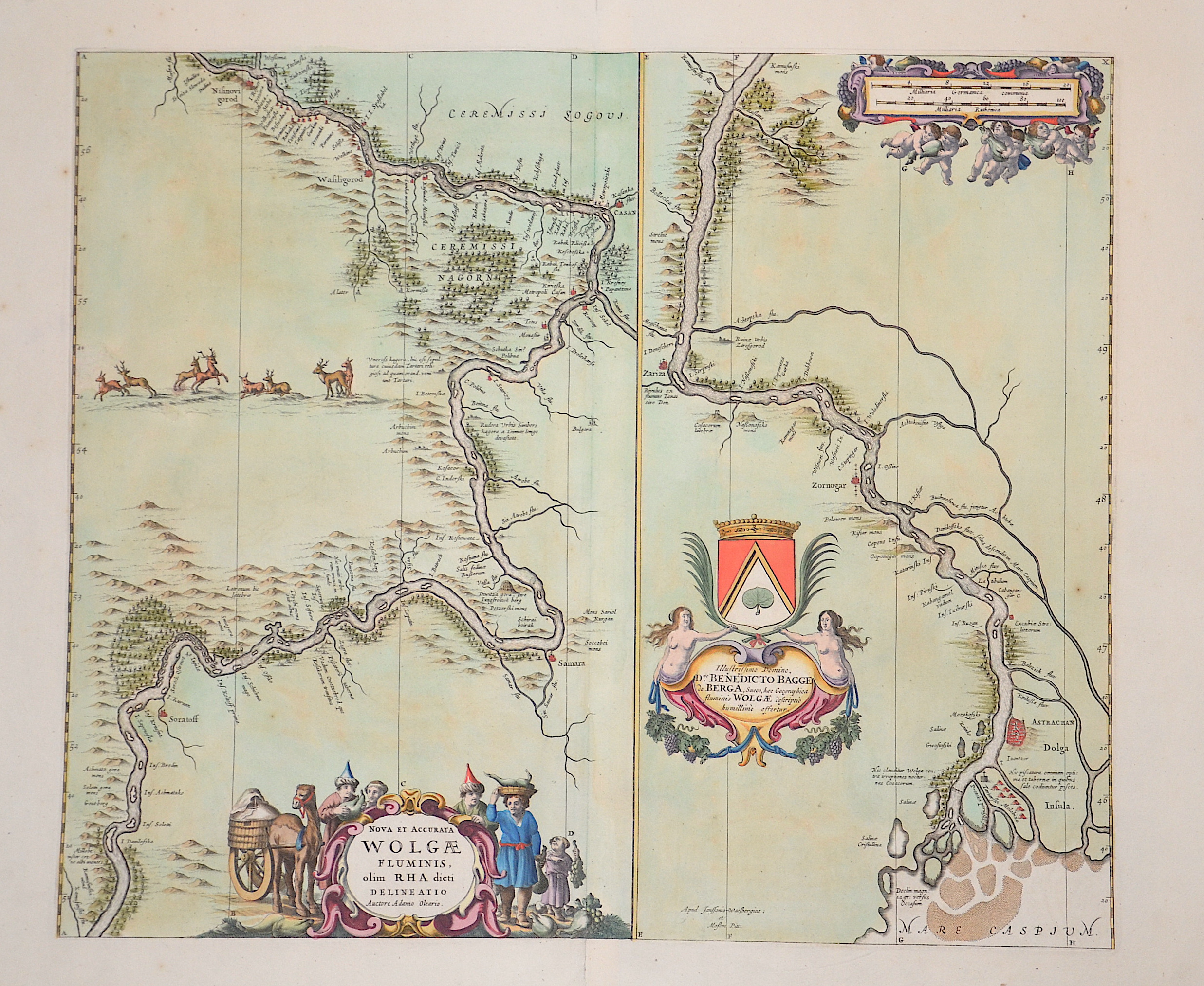
Nova et accurata Wolgae Fluminis, olim Rha dicti delineatio / Illustrissimo Domino, Dno. Benedicto Bagge de Berga…
| Article ID | EUO3566 |
Title | Nova et accurata Wolgae Fluminis, olim Rha dicti delineatio / Illustrissimo Domino, Dno. Benedicto Bagge de Berga… |
Decorative map of the river Wolga two maps with three catouches. The Wolga river mouth to the Caspian sea with the cities Astrachan, Zariza (Wolgograd)aund Zornogar. The other map shows the river Wolga with the cities Nisinovigorod (Nizhnij Nowgorod), Casan (Kasan), Samara bis nach Soratoff (Saratow). | |
| Year | ca. 1610 |
Artist | Blaeu |
| Place of Publication | Amsterdam |
| Dimensions (cm) | 46,5 x 55 |
| Condition | Some restoration at lower centerfold |
| Coloring | original colored |
| Technique | Copper print |
:
94.50 €
( A reproduction can be ordered individually on request. )