

Adina Sommer
Antique and Contemporary Art
Winzerer Str. 154
80797 München
telephone
+49 89 304714
business hours:
by appointment
Email
![]()


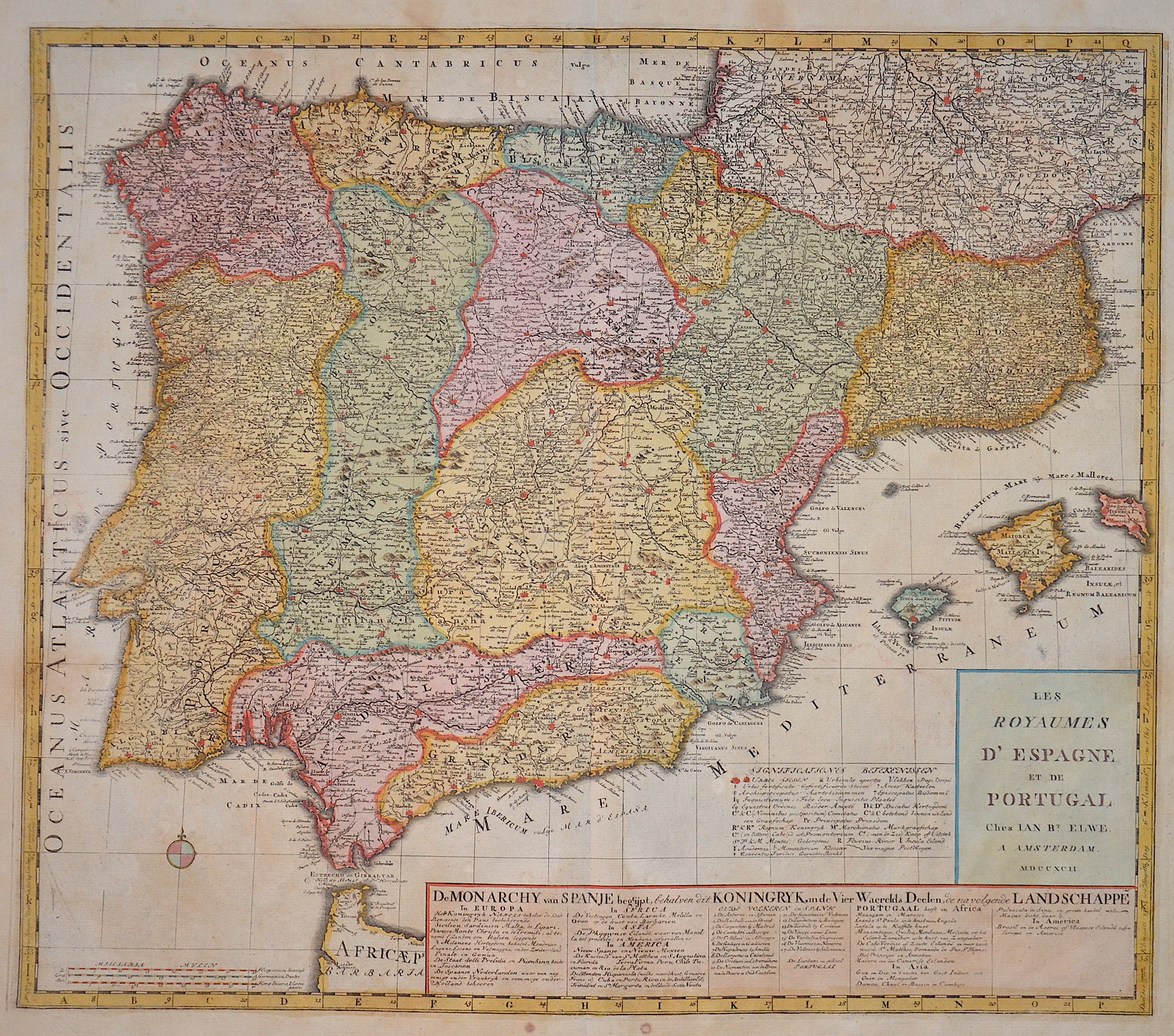
Les Royaumes d’Espagne et de Portugal
| Article ID | EUE3549 |
Title | Les Royaumes d’Espagne et de Portugal |
Map shows total Spain with Portugal and the Balearic island of Mallorca, Menorca and Ibiza with a decorative title cartouche. On the lower right pannel a description of the counties. | |
| Year | c. 1792 |
Artist | Elwe |
| Place of Publication | Amsterdam |
| Dimensions (cm) | 50 x 58 cm |
| Condition | Very good |
| Coloring | original colored |
| Technique | Copper print |
:
78.00 €
( A reproduction can be ordered individually on request. )