

Adina Sommer
Antique and Contemporary Art
Winzerer Str. 154
80797 München
telephone
+49 89 304714
business hours:
by appointment
Email
![]()


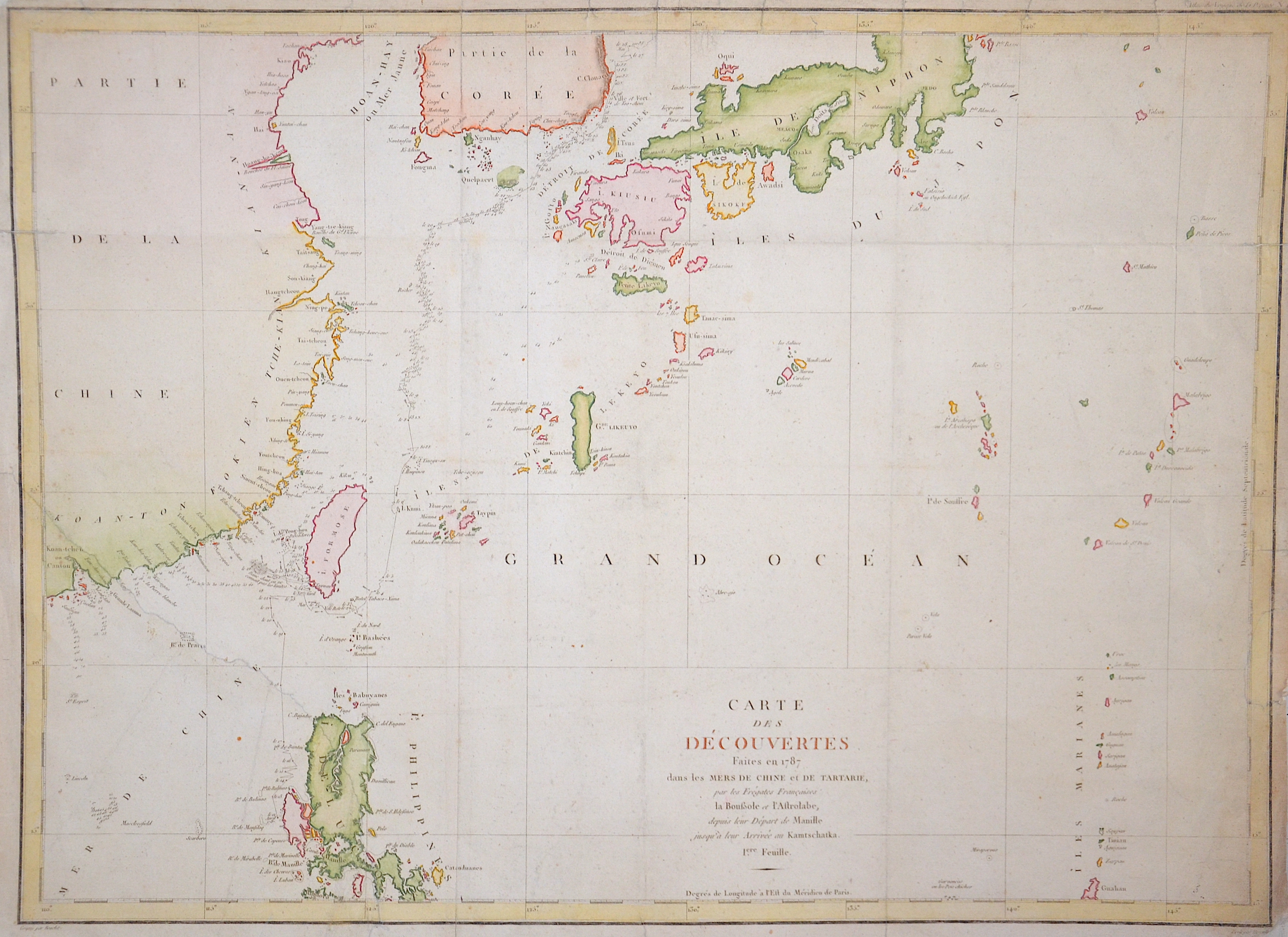
Carte des découvertes faites en 1778 dans les Mers de Chine et de Tartarie…
| Article ID | SE0248 |
Title | Carte des découvertes faites en 1778 dans les Mers de Chine et de Tartarie… |
Map shows the Pacific ocean with South Corea, Islands of Riu -Kiu, Tai- Wan, Islands Mariane and partly the Philipines | |
| Year | ca. 1797 |
Artist | Pérouse, la |
| Dimensions (cm) | 50 x 69 |
| Condition | Mounted, left lower corner replaced |
| Coloring | colored |
| Technique | Copper print |
:
72.00 €
( A reproduction can be ordered individually on request. )