

Adina Sommer
Antique and Contemporary Art
Winzerer Str. 154
80797 München
telephone
+49 89 304714
business hours:
by appointment
Email
![]()


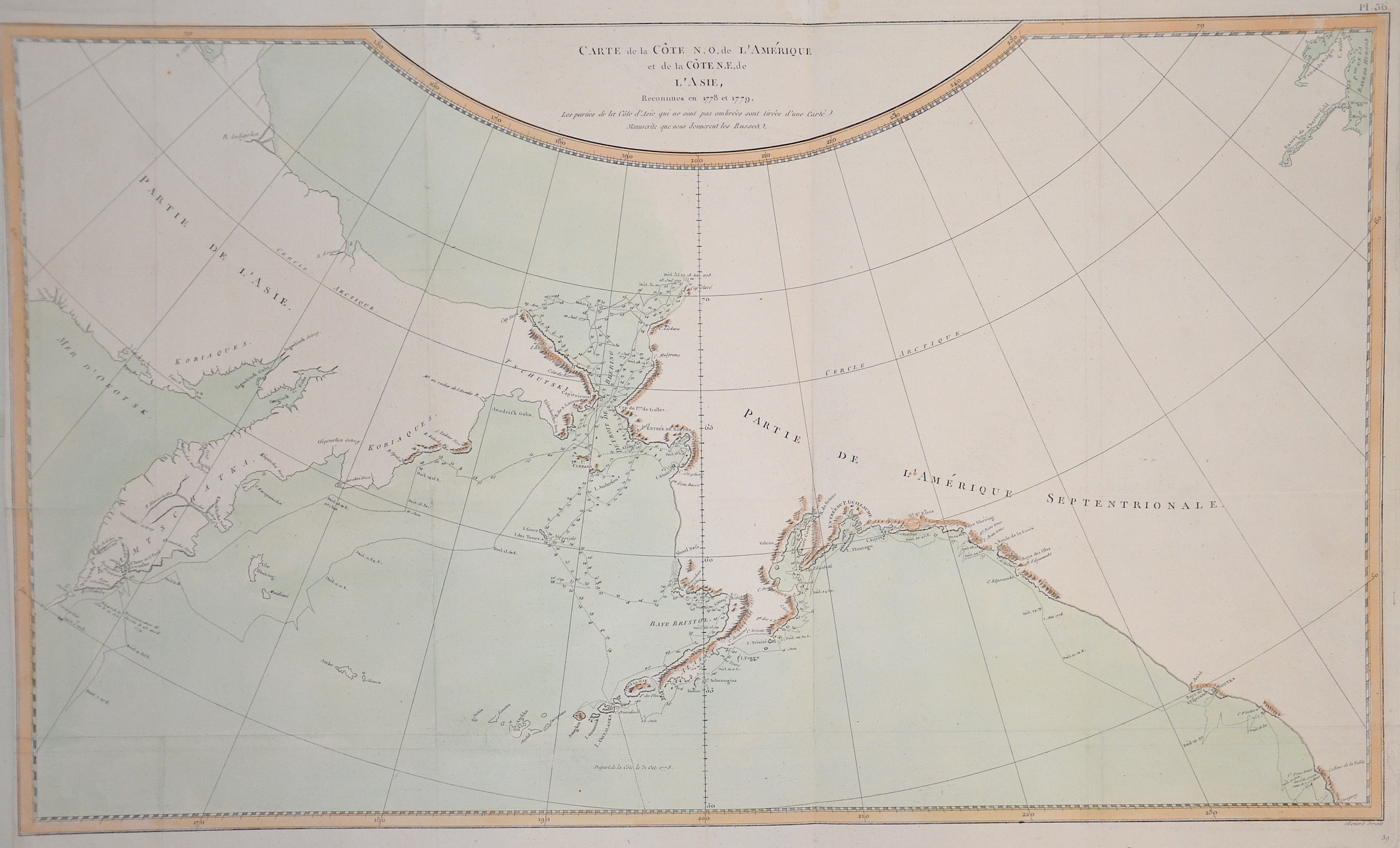
Carte de la Cote N.O. de L´Amerique et de la Cote N.E. de L´Asie

| Article ID | SE0257 |
Title | Carte de la Cote N.O. de L´Amerique et de la Cote N.E. de L´Asie |
Description | Map shows the Bering Sea between America and Asia |
| Year | ca. 1780 |
Artist | Benard (1734-1777) |
Robert Bénard (1734 in Paris – 1777) was an 18th-century French engraver. Specialized in the technique of engraving, Robert Bénard is mainly famous for having supplied a significant amount of plates (at least 1,800) to the Encyclopédie by Diderot & d'Alembert from 1751. Later, publisher Charles-Joseph Panckoucke reused many of his productions to illustrate the works of his catalog. | |
Historical Description | The Bering Strait is a strait of the Pacific, which separates Russia and Alaska slightly south of the Arctic Circle. The earliest reference of the strait were from maps from the Polo family; based on the adventures of Marco Polo. From at least 1562, European geographers thought that there was a Strait of Anián between Asia and North America. In 1648, Semyon Dezhnyov probably passed through the strait, but his report did not reach Europe. Danish-born Russian navigator Vitus Bering entered it in 1728. In 1732, Mikhail Gvozdev crossed it for the first time, from Asia to America. |
| Dimensions (cm) | 39 x 66,5 |
| Condition | Very good |
| Coloring | colored |
| Technique | Copper print |
Reproduction:
37.50 €
( A reproduction can be ordered individually on request. )