

Adina Sommer
Antique and Contemporary Art
Winzerer Str. 154
80797 München
telephone
+49 89 304714
business hours:
by appointment
Email
![]()


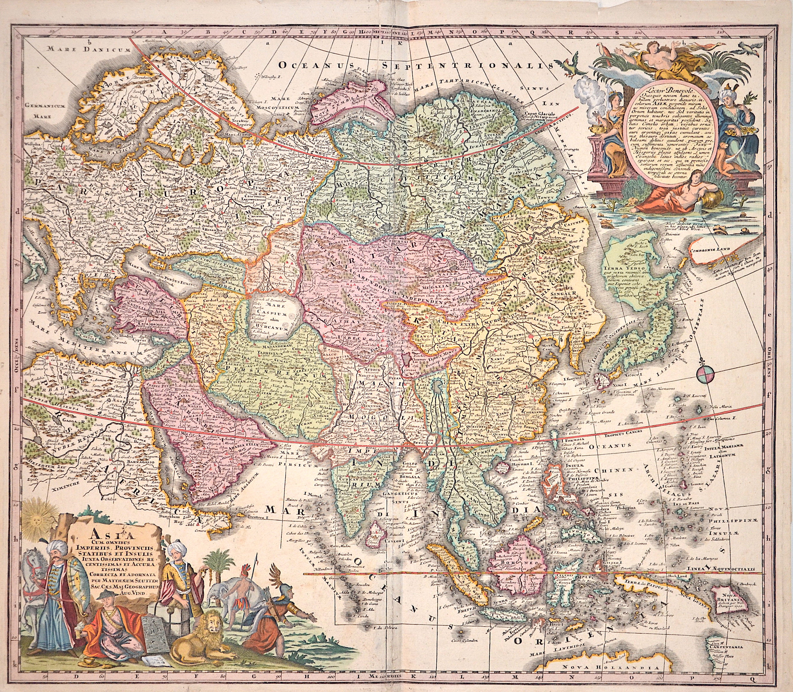
Asia cum omnibus Imperiis Provinciis, statibus et Insulis Luxta…

| Article ID | ASX284 |
Title | Asia cum omnibus Imperiis Provinciis, statibus et Insulis Luxta… |
Description | Map shows total Asia with detailed borders of thecountries and two decorative allegorical cartouches. |
| Year | ca. 1728 |
Artist | Seutter (1678-1757) |
Matthias Seutter (1678- 1757) Augsburg was the son of a goldsmith in Augsburg. In 1697, Seutter began his studies in Nuremberg and subsequently worked in the publishing house of Jeremias Wolff in Augsburg. In 1710, he established his own publishing house and print shop. The Seutter publishing house produced a great number of maps, atlases, and globes. However, very few original maps were printed there, as Augsburg at that time had no university and no connection to the fields of mathematics or the natural sciences. Seutter therefore copied the work of other cartographers, making his own engravings based on their models. Over 500 maps were produced in his studio. Seutter's most well-known works are the 1725 "Geographical Atlas or an Accurate Depiction of the Whole World" ("Atlas Geographicus oder Accurate Vorstellung der ganzen Welt") with 46 maps, the 1734 "Large Atlas" ("Grosser Atlas") with 131 maps, and the 1744 pocket atlas "Small Atlas" ("Atlas minor") with 64 maps. Matthäus Seutter died in 1757. Seutter's son Albrecht Karl, his son-in-law Conrad Tobias Lotter, and his business partner Johann Michael Probst ran the printing business for five more years. | |
Historical Description | Asia is Earth's largest and most populous continent, located primarily in the Eastern and Northern Hemispheres. The history of Asia can be seen as the distinct histories of several peripheral coastal regions: East Asia, South Asia, Southeast Asia and the Middle East, linked by the interior mass of the Central Asian steppes. The coastal periphery was home to some of the world's earliest known civilizations, each of them developing around fertile river valleys. The civilizations in Mesopotamia, the Indus Valley and the Yellow River shared many similarities. These civilizations may well have exchanged technologies and ideas such as mathematics and the wheel. Other innovations, such as writing, seem to have been developed individually in each area. Cities, states and empires developed in these lowlands. The central steppe region had long been inhabited by horse-mounted nomads who could reach all areas of Asia from the steppes. The earliest postulated expansion out of the steppe is that of the Indo-Europeans, who spread their languages into the Middle East, South Asia, and the borders of China, where the Tocharians resided. The northernmost part of Asia, including much of Siberia, was largely inaccessible to the steppe nomads, owing to the dense forests, climate and tundra. These areas remained very sparsely populated. The center and the peripheries were mostly kept separated by mountains and deserts. The Caucasus and Himalaya mountains and the Karakum and Gobi deserts formed barriers that the steppe horsemen could cross only with difficulty. While the urban city dwellers were more advanced technologically and socially, in many cases they could do little in a military aspect to defend against the mounted hordes of the steppe. However, the lowlands did not have enough open grasslands to support a large horsebound force; for this and other reasons, the nomads who conquered states in China, India, and the Middle East often found themselves adapting to the local, more affluent societies. |
| Place of Publication | Augsburg |
| Dimensions (cm) | 50 x 58,5 cm |
| Condition | Restoration at centerfold |
| Coloring | original colored |
| Technique | Copper print |
Reproduction:
127.50 €
( A reproduction can be ordered individually on request. )