

Adina Sommer
Antique and Contemporary Art
Winzerer Str. 154
80797 München
telephone
+49 89 304714
business hours:
by appointment
Email
![]()


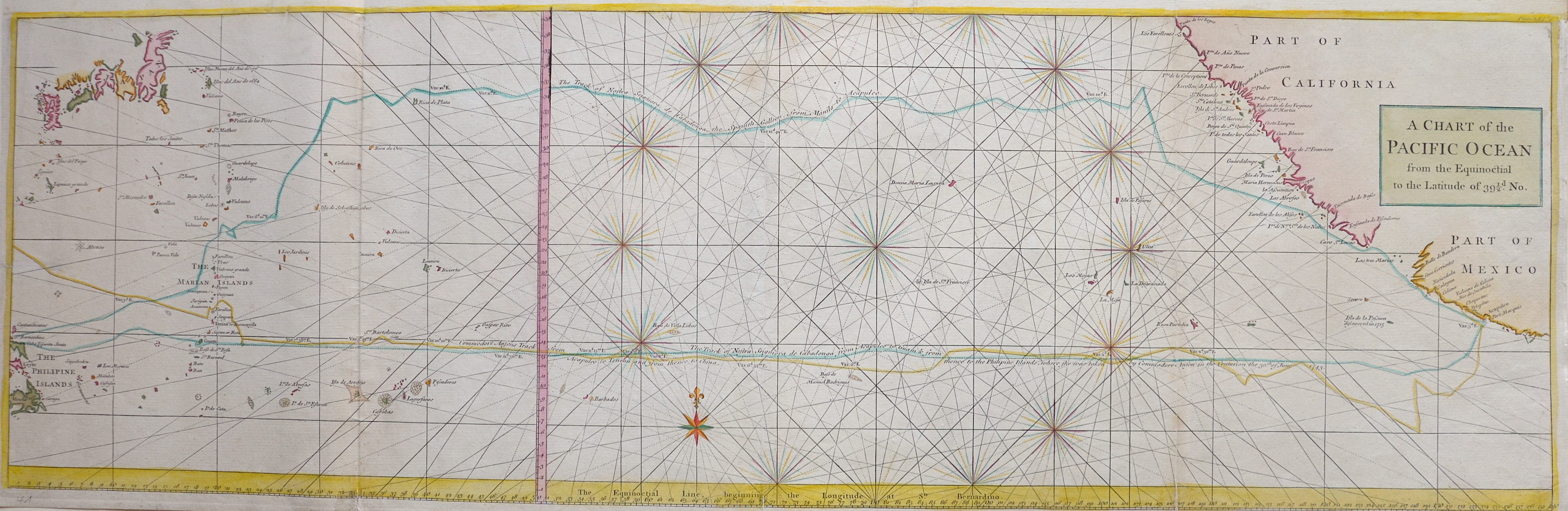
A Chart of the Pacific Ocean from the Equinoctial to the Latitude of 39 1/2d. No.

| Article ID | SE0306 |
Title | A Chart of the Pacific Ocean from the Equinoctial to the Latitude of 39 1/2d. No. |
Description | Chart of the northern Pacific Ocean with Japan, the Philippines, California and Mexico and showing the city Acapulco de Juárezu. |
| Year | ca. 1760 |
Artist | Anson (1697-1762) |
Admiral of the Fleet George Anson (1697 -1762) , was a Royal Navy officer. The interrest of his friend, the poet richard Cambridges encouraged him to issue the historical work: An account of the war in India between the English and French, on the coast of Coromandel, from the year 1750 to the year 1760. Together with a relation of the late remarkable events on the Malabar coast, and the expeditions to Golconda and Surat. T. Jefferys, London 1761. | |
Historical Description | The Pacific Ocean is the largest and deepest of Earth's oceanic divisions. Though the peoples of Asia and Oceania have traveled the Pacific Ocean since prehistoric times, the eastern Pacific was first sighted by Europeans in the early 16th century when Spanish explorer Vasco Núñez de Balboa crossed the Isthmus of Panama in 1513 and discovered the great "southern sea" which he named Mar del Sur (in Spanish). In 1519, Portuguese explorer Ferdinand Magellan sailed the Pacific East to West on a Spanish expedition to the Spice Islands that would eventually result in the first world circumnavigation. Magellan called the ocean Pacífico (or "Pacific" meaning, "peaceful") because, after sailing through the stormy seas off Cape Horn, the expedition found calm waters. The ocean was often called the Sea of Magellan in his honor until the eighteenth century. |
| Place of Publication | London |
| Dimensions (cm) | 27,5 x 87,5 |
| Condition | Upper margin replaiced, tear in the middle restored |
| Coloring | colored |
| Technique | Copper print |
Reproduction:
58.50 €
( A reproduction can be ordered individually on request. )