

Adina Sommer
Antique and Contemporary Art
Winzerer Str. 154
80797 München
telephone
+49 89 304714
business hours:
by appointment
Email
![]()


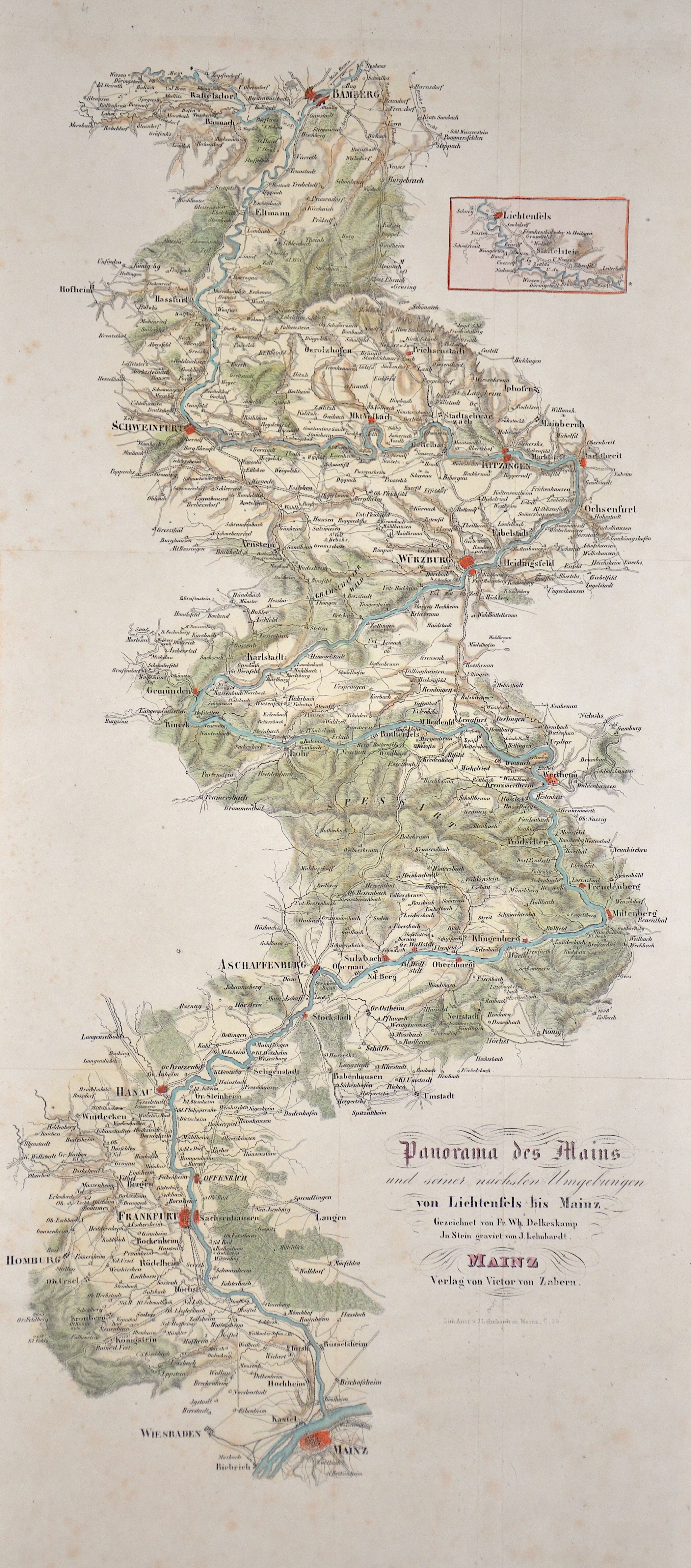
Panorama des Mains und seiner nächsten Umgebungen von Lichtenfels bis Mainz
| Article ID | EUD4382 |
Title | Panorama des Mains und seiner nächsten Umgebungen von Lichtenfels bis Mainz |
Description | Map shows the Main course from Lichtenfels (Bavaria) via Bamberg, Schweinfurt, Kitzingen, Würzburg, Gemünden, Aschaffenburg, Hanau, Frankfurt to Mainz (Rhineland-Palatinate). |
| Year | ca. 1820 |
Artist | Kunstanstalt v. J. Lehnhardt |
Historical Description | The source rivers of the Main originate in the Fichtelgebirge (White Main) and in the Franconian Jura (Red Main). On the western edge of the town of Kulmbach in the Melkendorf district near Steinenhausen Castle, the two source rivers unite to form the actual Main. Despite many striking changes in direction, the course of the river maintains its main east-west direction, which is rare in Central Europe, and touches several Franconian low mountain ranges. Large parts of the Franconian wine-growing region and numerous, partly well-preserved historical city centers lie on the Main. The Main flows through large conurbations around Würzburg and Frankfurt. Opposite the old town of Mainz - between Ginsheim-Gustavsburg and the Maaraue in Mainz-Kostheim - it flows into the Rhine. |
| Place of Publication | Mainz |
| Dimensions (cm) | 50 x 23 cm |
| Condition | Perfect condition |
| Coloring | original colored |
| Technique | Lithography |
Reproduction:
48.00 €
( A reproduction can be ordered individually on request. )