

Adina Sommer
Antique and Contemporary Art
Winzerer Str. 154
80797 München
telephone
+49 89 304714
business hours:
by appointment
Email
![]()


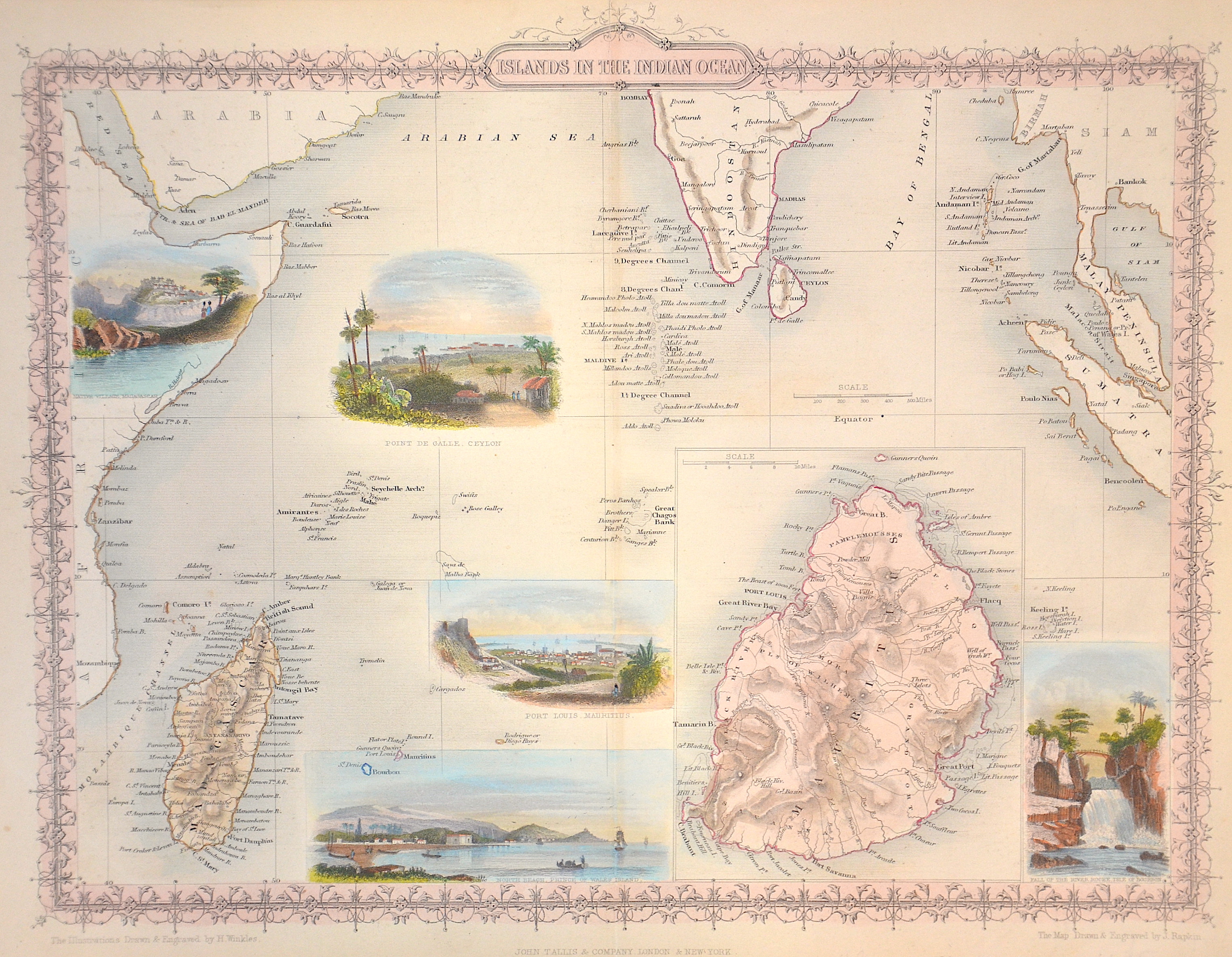
Isalnds in the Indian Ocean

| Article ID | AF0292 |
Title | Isalnds in the Indian Ocean |
Description | Map shows the Indian Ocaen with Madakascar and the Maledives, Mauritius on inset map. With 5 views of harbours and population. |
| Year | ca. 1840 |
Artist | Tallis (1817-1876) |
John Tallis was an English cartographic publisher. His company, John Tallis and Company, published views, maps and atlases in London from roughly 1838 to 1851. | |
| Place of Publication | London |
| Dimensions (cm) | 25,5 x 34 |
| Condition | Very good |
| Coloring | original colored |
| Technique | Lithography |
Reproduction:
16.50 €
( A reproduction can be ordered individually on request. )