

Adina Sommer
Antique and Contemporary Art
Winzerer Str. 154
80797 München
telephone
+49 89 304714
business hours:
by appointment
Email
![]()


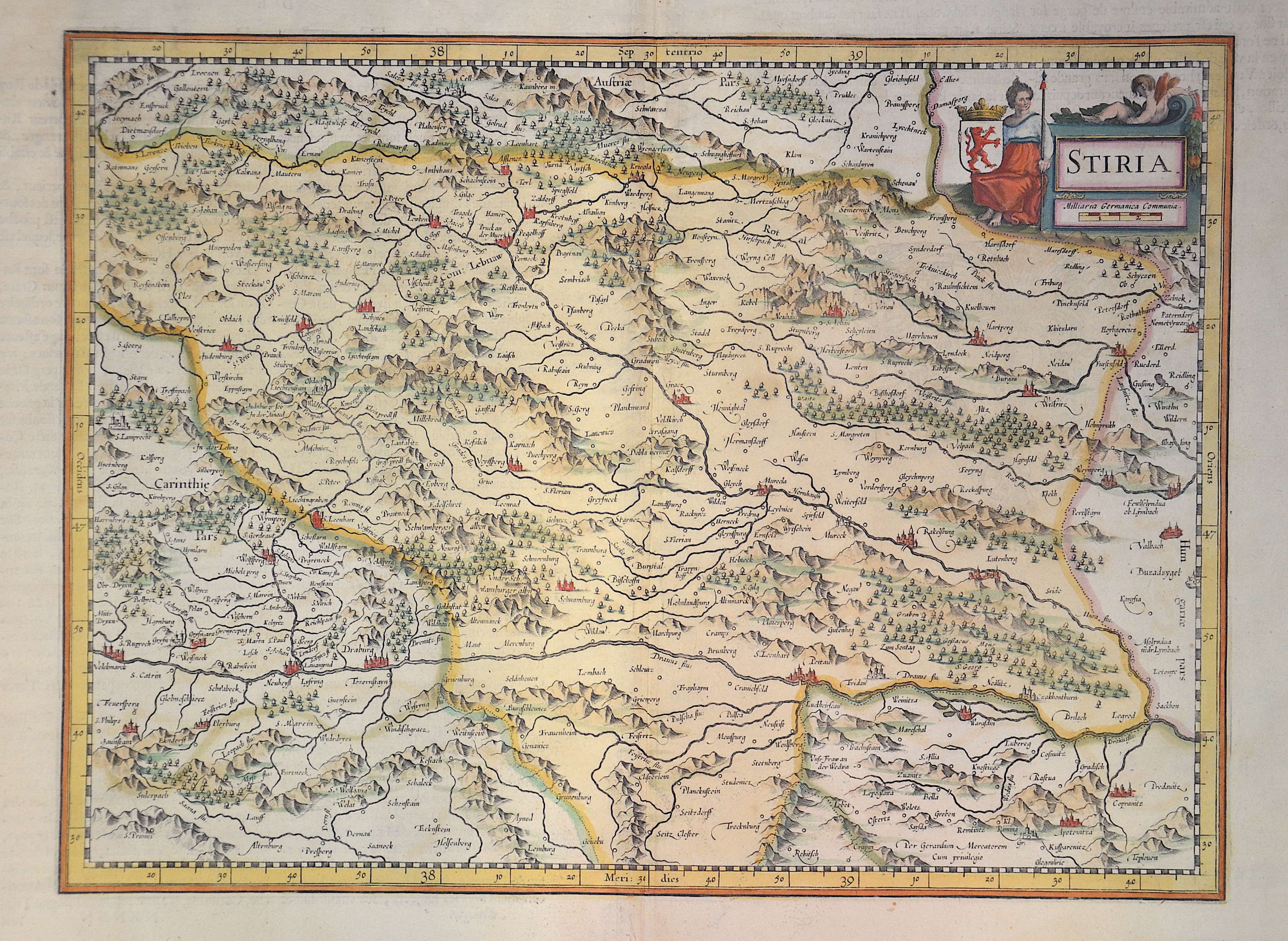
Stiria

| Article ID | EUA1234 |
Title | Stiria |
Description | Map shows Styria in Austria |
| Year | ca. 1630 |
Artist | Mercator (1512-1594) |
Gerardus Mercator (1512 - 1594). He was a cartographer, philosopher and mathematician. He is best known for his work in cartography, in particular the world map of 1569 based on a new projection which represented sailing courses of constant bearing as straight lines. He is renowned to the present day as the cartographer who created a world map based on a new projection which represented sailing courses of constant bearing as straight lines. In his own day he was the world's most famous geographer but in addition he had interests in theology, philosophy, history, mathematics and magnetism as well as being an accomplished engraver, calligrapher and maker of globes and scientific instruments. He wrote few books but much of his knowledge is to be found in the copious legends on his wall maps and the prefaces that he composed for his atlas ,the first in which the term "atlas" appears and the sections within it. | |
Historical Description | The name Austria is first handed down in its Old High German form Ostarrichi from the year 996. The Latin form Austria was also used. In 1156 Austria became an independent duchy in the Holy Roman Empire. After the Babenbergs died out in 1246, the House of Habsburg prevailed in the struggle for rule in Austria. The area designated as Austria later included the entire Habsburg Monarchy and later the Austrian Empire, which was constituted in 1804, and the Austrian half of the Austro-Hungarian Dual Monarchy established in 1867. The present republic came into being in 1918. |
| Place of Publication | Duisburg |
| Dimensions (cm) | 30,5 x 41 |
| Condition | Some restoration at centerfold |
| Coloring | colored |
| Technique | Copper print |
Reproduction:
58.50 €
( A reproduction can be ordered individually on request. )