

Adina Sommer
Antique and Contemporary Art
Winzerer Str. 154
80797 München
telephone
+49 89 304714
business hours:
by appointment
Email
![]()


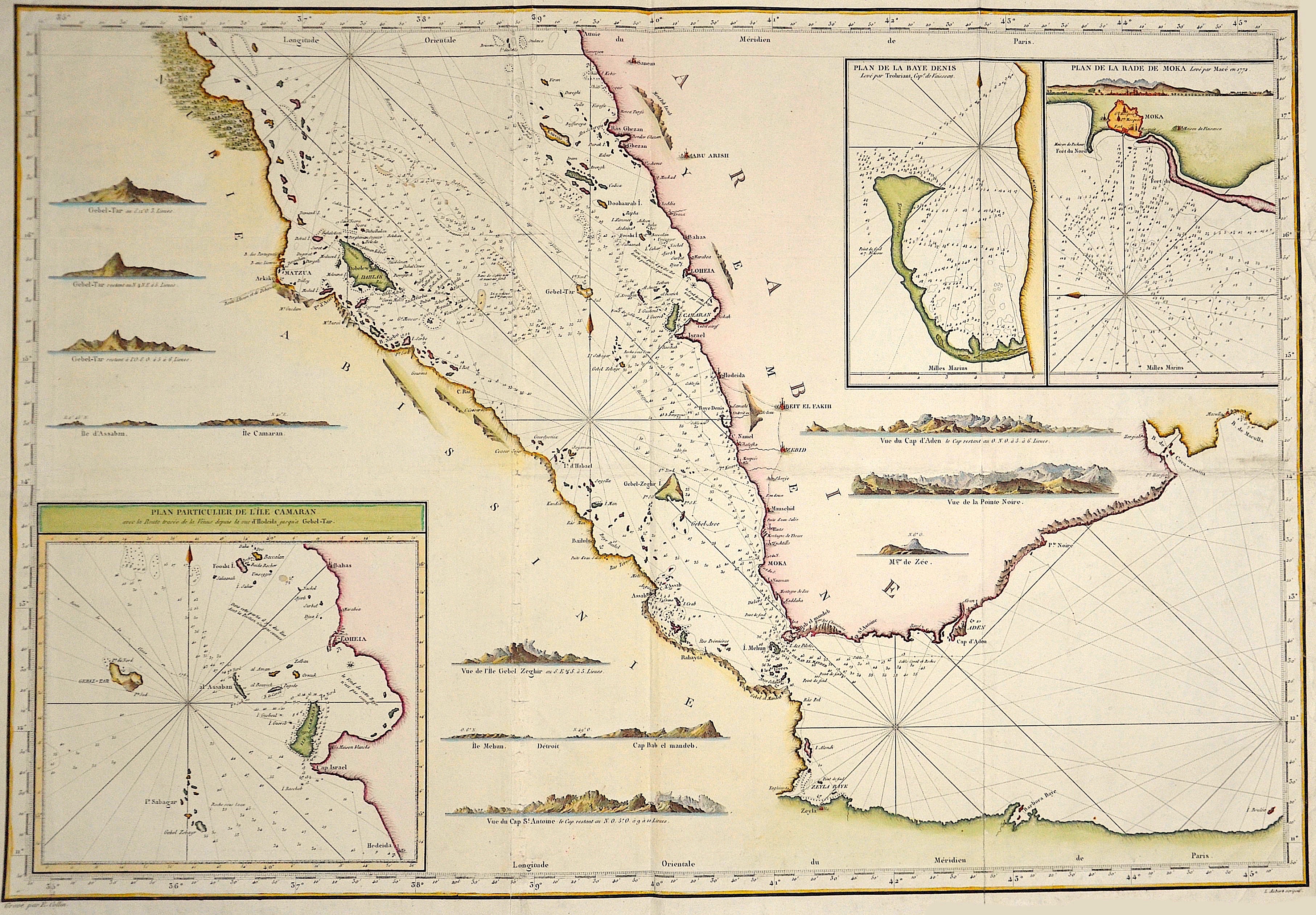
Plan particulier de l´Isle Cameran……..

| Article ID | SE228 |
Title | Plan particulier de l´Isle Cameran…….. |
Description | Map shows the south part of the red sea |
| Year | ca. 1790 |
Artist | Collin |
Historical Description | It is a narrow, 2240 km long, in its central Suakin Trough to 3040 m deep tributary sea of the Indian Ocean between northeast Africa and the Arabian Peninsula. It includes Gulf of Suez, the connection through the Suez Canal to the Mediterranean Sea. The Gulf of Aqaba (northeastern part) with the adjacent states, Israel (city of Eilat), Jordan (city of Aqaba), Saudi Arabia, Egypt and Bab al-Mandab, the strait in the south to the Gulf of Aden or to the Indian Ocean with the adjacent states, Eritrea, Djibouti and Yemen. The naming probably comes from the ancient system of designating cardinal points by colors. The Persian Achaimenids, an early Iranian people, first named it Red Sea because it was located in the south, which was symbolized by the color red. So red sea meant "South Sea" (and analogously the Black Sea "North Sea"). Already in ancient times there were several canal projects connecting the Mediterranean Sea with the Red Sea. The Suez Canal, completed in the 19th century. The Red Sea Dam is a speculative macro-engineering proposal to close off and lower the Red Sea by means of a dam from the 1960s, which was taken up and expanded by Utrecht University in 2007. |
| Dimensions (cm) | 60 x 86 |
| Condition | Some folds partly restored |
| Coloring | colored |
| Technique | Copper print |
Reproduction:
187.50 €
( A reproduction can be ordered individually on request. )