

Adina Sommer
Antique and Contemporary Art
Winzerer Str. 154
80797 München
telephone
+49 89 304714
business hours:
by appointment
Email
![]()


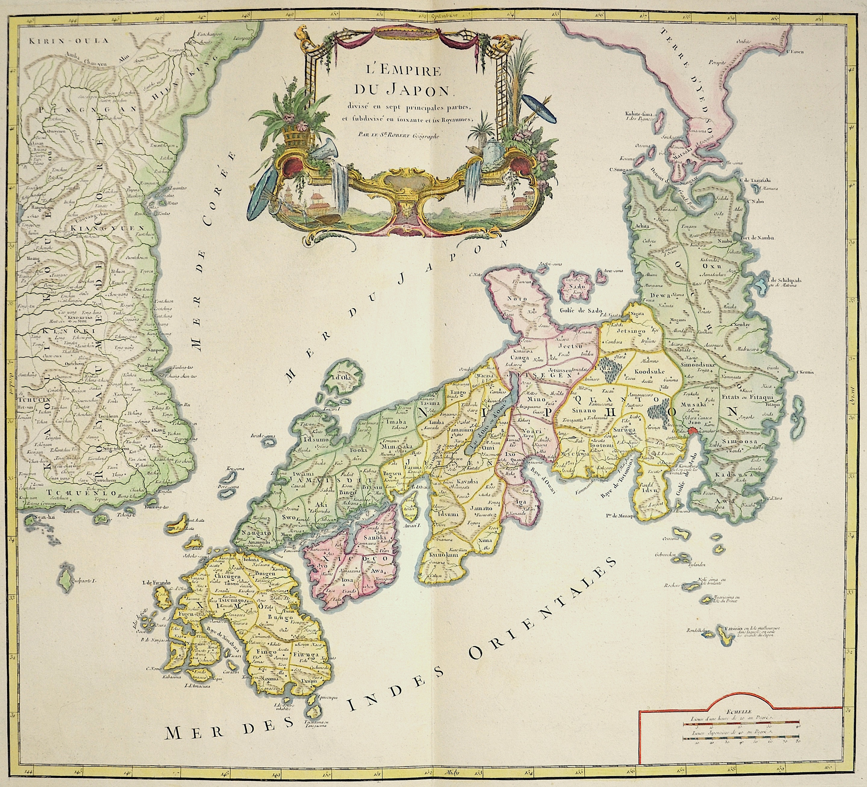
L´Empire du Japon, divisee en sept principales parties et subdivise en foixante et fix Royaume..

| Article ID | ASN0475 |
Title | L´Empire du Japon, divisee en sept principales parties et subdivise en foixante et fix Royaume.. |
Description | Map shows total Japan |
| Year | ca. 1750 |
Artist | Vaugondy, de (1723-1786) |
Didier Robert de Vaugondy (1723 -1786) also known as Le Sieur or Monsieur Robert, and his son, were leading cartographers in France during the 18th century. In 1757, Gilles and Didier Robert De Vaugondy published The Atlas Universel, one of the most important atlases of the 18th century. To produce the atlas, the Vaugondys integrated older sources with more modern surveyed maps. They verified and corrected the latitude and longitude of many regional maps in the atlas with astronomical observations. The older material was revised with the addition of many new place names. In 1760, Didier Robert de Vaugondy was appointed geographer to Louis XV. Gilles and Didier Robert De Vaugondy produced their maps and terrestrial globes working together as father and son. Globes of a variety of sizes were made by gluing copperplate-printed gores on a plaster-finished papier-mache core, a complicated and expensive manufacturing process, employing several specialists. In some cases it is uncertain whether Gilles or Didier made a given map. Gilles often signed maps as M.Robert, while Didier commonly signed his maps as ""Robert de Vaugondy"", or added ""fils"" or ""filio"" after his name. The Robert de Vaugondys were descended from the Nicolas Sanson family through Sanson's grandson, Pierre Moulard-Sanson. From him, they inherited much of Sanson's cartographic material, which they combined with maps and plates acquired after Hubert Jaillot's death in 1712 to form the basis the Atlas Universel. | |
| Place of Publication | Paris |
| Dimensions (cm) | 48 x 54 |
| Condition | Outer margin perfectly restored tears |
| Coloring | colored |
| Technique | Copper print |
Reproduction:
120.00 €
( A reproduction can be ordered individually on request. )