

Adina Sommer
Antique and Contemporary Art
Winzerer Str. 154
80797 München
telephone
+49 89 304714
business hours:
by appointment
Email
![]()


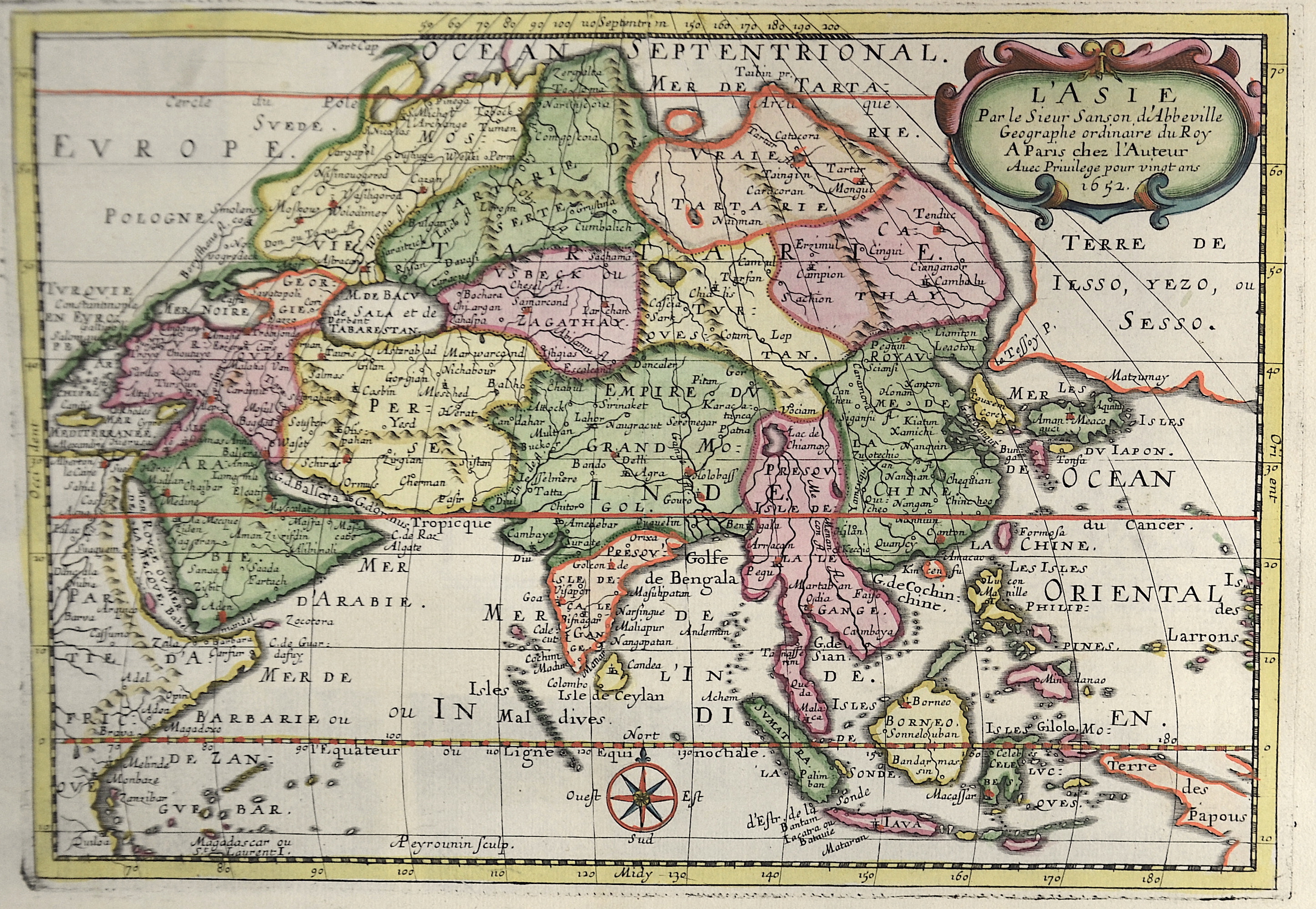
L´Asie par les Sieur Sanson d´Abbeville

| Article ID | ASX0455 |
Title | L´Asie par les Sieur Sanson d´Abbeville |
Description | Map shows total Asia |
| Year | dated 1652 |
Artist | Sanson (1600-1667) |
Nicolas Sanson (1600–1667) was a French cartographer, termed by some the creator of French geography, in which he's been called the father of French cartography. Active from 1627, Sanson issued his first map of importance, the ""Postes de France"", which was published by Melchior Tavernier in 1632. After publishing several general atlases himself he became the associate of Pierre Mariette, a publisher of prints. In 1647 Sanson accused the Jesuit Philippe Labbe of plagiarizing him in his Pharus Galliae Antiquae; in 1648 he lost his eldest son Nicolas, killed during the Fronde. Among the friends of his later years was the great Condé. He died in Paris on 7 July 1667. Two younger sons, Adrien (d. 1708) and Guillaume (d. 1703), succeeded him as geographers to the king. In 1692 Hubert Jaillot collected Sanson's maps in an Atlas nouveau. See also the 18th century editions of some of Sanson's works on Delamarche under the titles of Atlas de géographie ancienne and Atlas britannique; and the Catalogue des cartes et livres de géographie de Sanson (1702). | |
Historical Description | Asia is Earth's largest and most populous continent, located primarily in the Eastern and Northern Hemispheres. The history of Asia can be seen as the distinct histories of several peripheral coastal regions: East Asia, South Asia, Southeast Asia and the Middle East, linked by the interior mass of the Central Asian steppes. The coastal periphery was home to some of the world's earliest known civilizations, each of them developing around fertile river valleys. The civilizations in Mesopotamia, the Indus Valley and the Yellow River shared many similarities. These civilizations may well have exchanged technologies and ideas such as mathematics and the wheel. Other innovations, such as writing, seem to have been developed individually in each area. Cities, states and empires developed in these lowlands. The central steppe region had long been inhabited by horse-mounted nomads who could reach all areas of Asia from the steppes. The earliest postulated expansion out of the steppe is that of the Indo-Europeans, who spread their languages into the Middle East, South Asia, and the borders of China, where the Tocharians resided. The northernmost part of Asia, including much of Siberia, was largely inaccessible to the steppe nomads, owing to the dense forests, climate and tundra. These areas remained very sparsely populated. The center and the peripheries were mostly kept separated by mountains and deserts. The Caucasus and Himalaya mountains and the Karakum and Gobi deserts formed barriers that the steppe horsemen could cross only with difficulty. While the urban city dwellers were more advanced technologically and socially, in many cases they could do little in a military aspect to defend against the mounted hordes of the steppe. However, the lowlands did not have enough open grasslands to support a large horsebound force; for this and other reasons, the nomads who conquered states in China, India, and the Middle East often found themselves adapting to the local, more affluent societies. |
| Place of Publication | Paris |
| Dimensions (cm) | 19 x 27,5 |
| Condition | Very good |
| Coloring | original colored |
| Technique | Copper print |
Reproduction:
58.50 €
( A reproduction can be ordered individually on request. )