

Adina Sommer
Antique and Contemporary Art
Winzerer Str. 154
80797 München
telephone
+49 89 304714
business hours:
by appointment
Email
![]()


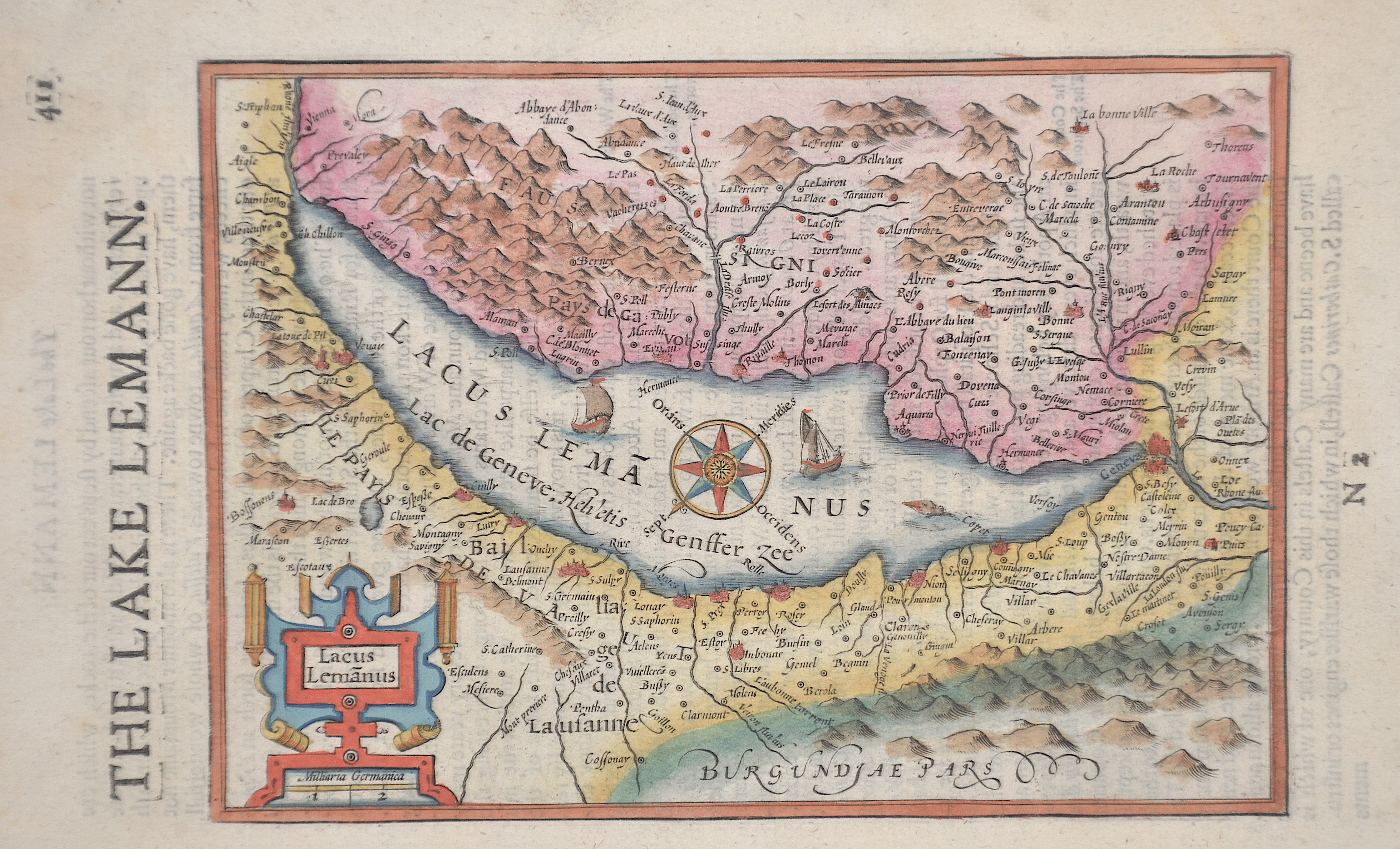
Lacus Lamanus

| Article ID | EUC2461 |
Title | Lacus Lamanus |
Description | Map shows Lake Geneva in Switzerland with a compass rose, ship charts and a title cartouche. |
| Year | ca. 1610 |
Artist | Bertius (1565-1629) |
Petrus Bertius (1565 -1629) was a Flemish theologian, historian, geographer and cartographer, He grew up in Beveren (Flanders). In 1593 he was appointed mathematics professor and librarian of the University of Leyden. His main cartographic work includes a miniature world atlas of 1600, a pocket atlas of the German Empire of 1616 with 26 engraved maps and 101 city views, a version of the Geographia of Ptolemy with 28 maps by Mercator and 14 maps from the Parergon of Ortelius of 1618, but he is known today as a cartographer with his edition of the Geographia of Ptolemy (based on Mercator's edition of 1578) and for his atlas. | |
Historical Description | Since 1848, the Swiss Confederation has been a federal state of relatively autonomous cantons, some of which have a history of confederacy that goes back more than 700 years, putting them among the world's oldest surviving republics. The early history of the region is tied to that of Alpine culture. Switzerland was inhabited by Gauls and Raetians, and it came under Roman rule in the 1st century BC. Gallo-Roman culture was amalgamated with Germanic influence during Late Antiquity, with the eastern part of Switzerland becoming Alemannic territory. The area of Switzerland was incorporated into the Frankish Empire in the 6th century. In the high medieval period, the eastern part became part of the Duchy of Swabia within the Holy Roman Empire while the western part was part of Burgundy |
| Place of Publication | Amsterdam |
| Dimensions (cm) | 14 x 20 cm |
| Condition | Very good |
| Coloring | original colored |
| Technique | Copper print |
Reproduction:
33.00 €
( A reproduction can be ordered individually on request. )