

Adina Sommer
Antique and Contemporary Art
Winzerer Str. 154
80797 München
telephone
+49 89 304714
business hours:
by appointment
Email
![]()


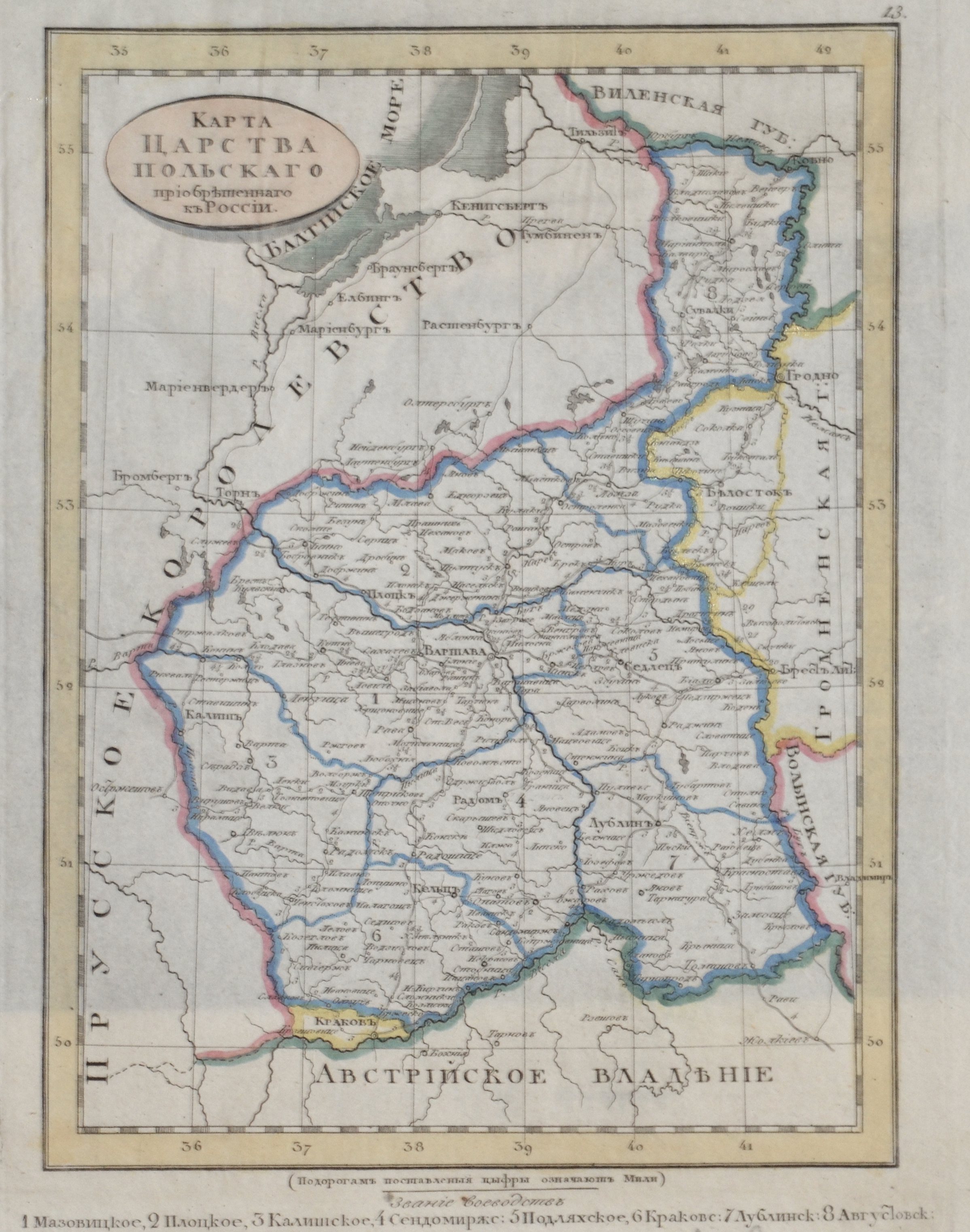
Karte vom Königreich Polen

| Article ID | EUP3996 |
Title | Karte vom Königreich Polen |
Description | Detailed map of Poland in cyrillic script, rare russian edition. |
| Year | ca. 1835 |
Artist | Saveshov |
Historical Description | Poland is bordered by the Baltic Sea, Russia's Kaliningrad Oblast and Lithuania to the north, Belarus and Ukraine to the east, Slovakia and Czech Republic, to the south, and Germany to the west. The establishment of the Polish state can be traced back to AD 966, when Mieszko I ruler of the realm coextensive with the territory of present-day Poland, converted to Christianity. The Kingdom of Poland was founded in 1025, and in 1569 it cemented its longstanding political association with the Grand Duchy of Lithuania. This union formed the Polish–Lithuanian Commonwealth, one of the largest at the end of the 18th century. Poland regained its independence in 1918 with the Treaty of Versailles. It was one of the most populous countries of 16th- and 17th-century Europe, with a uniquely liberal political system, which adopted Europe's first written national constitution, the Constitution of 3 May 1791. |
| Place of Publication | St. Petersburg |
| Dimensions (cm) | 22 x 16 |
| Condition | Perfect condition |
| Coloring | original colored |
| Technique | Copper print |
Reproduction:
63.00 €
( A reproduction can be ordered individually on request. )