

Adina Sommer
Antique and Contemporary Art
Winzerer Str. 154
80797 München
telephone
+49 89 304714
business hours:
by appointment
Email
![]()


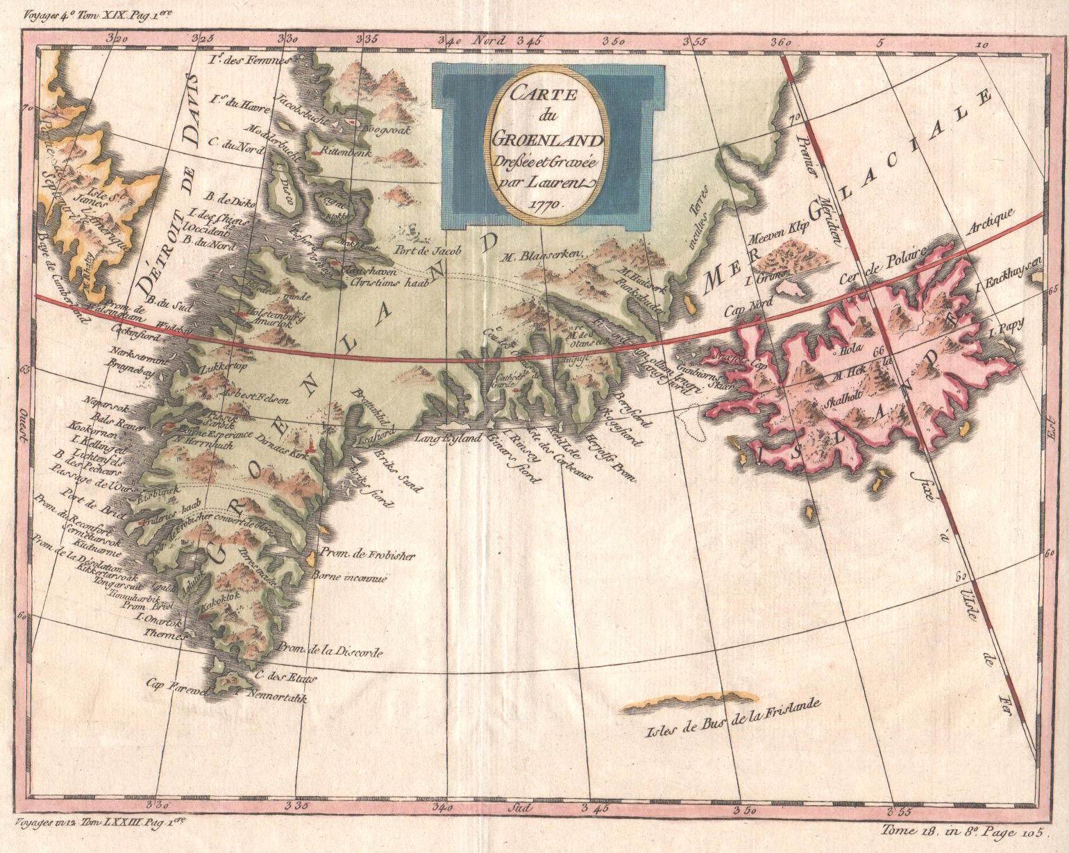
Carte du Groenland

| Article ID | EUS1337 |
Title | Carte du Groenland |
Description | Map shows total Greenland with Island. Greenland is an autonomous constituent country within the Kingdom of Denmark between the Arctic and Atlantic Oceans, east of the Canadian Arctic Archipelago. Though physiographically a part of the continent of North America, Greenland has been politically and culturally associated with Europe (specifically Norway and Denmark, the colonial powers, as well as the nearby island of Iceland). It is the world's largest island. |
| Year | dated 1770 |
Artist | Laurent |
| Place of Publication | Paris |
| Dimensions (cm) | 19 x 25 |
| Condition | Very good |
| Coloring | original colored |
| Technique | Copper print |
Reproduction:
21.00 €
( A reproduction can be ordered individually on request. )