

Adina Sommer
Antique and Contemporary Art
Winzerer Str. 154
80797 München
telephone
+49 89 304714
business hours:
by appointment
Email
![]()


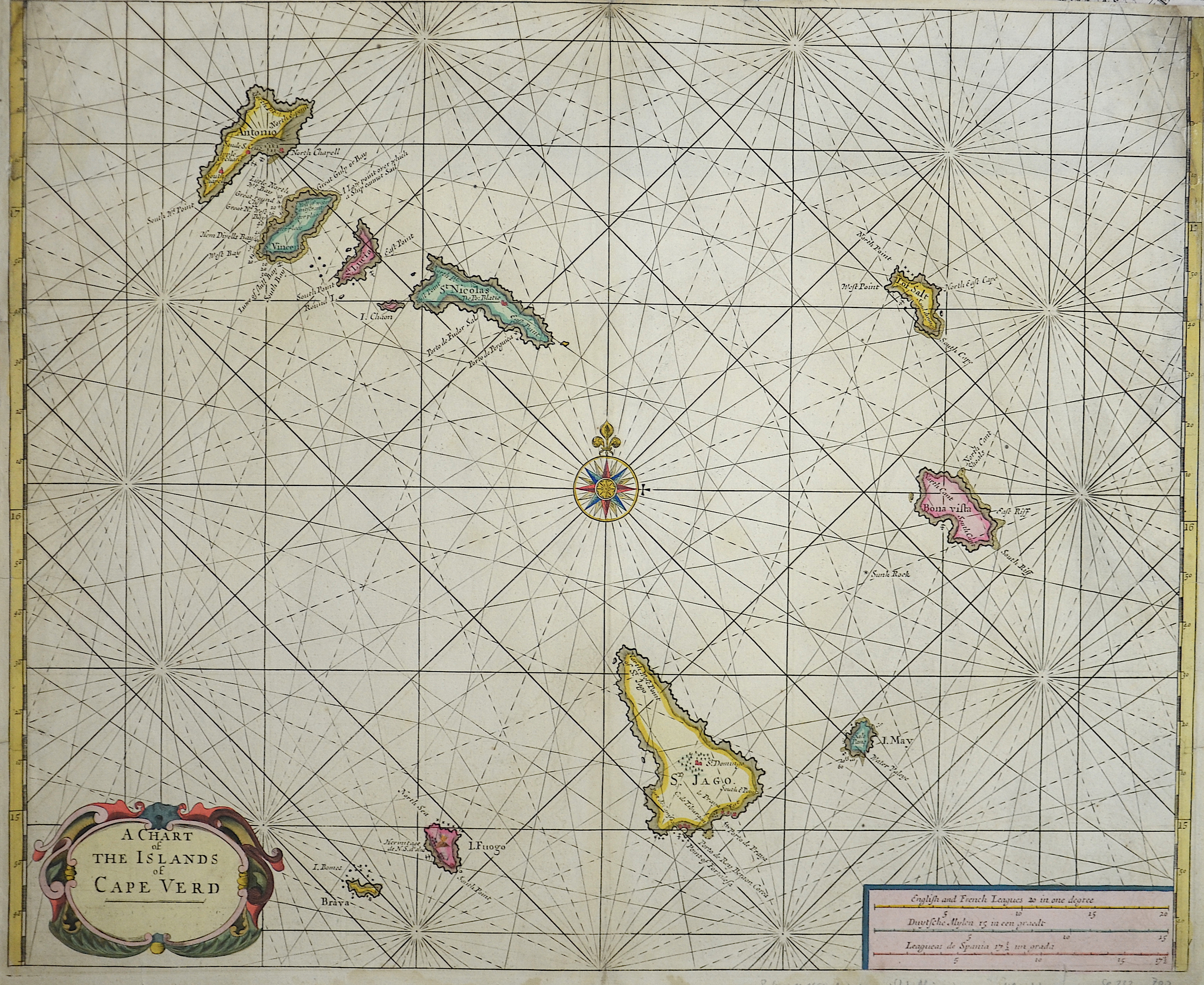
A charte of the island of Cap Verd

| Article ID | SE232 |
Title | A charte of the island of Cap Verd |
Description | Map shows the Island of Cap Verde |
| Year | ca. 1650 |
Artist | Goos (1590-1643) |
Abraham Goos (1590–1643), was a cartographer and map seller. He has published numerous globes, land and sea maps together with Jodocus Hondius and Johannes Janssonius in Antwerp. From 1666, Pieter Goos, his son, also published a number of well produced atlases. He was the first to map Christmas Island, which he labelled ""Mony"" in his map of the East Indies, published in his 1666 Zee-Atlas (Sea Atlas). His Atlas ofte Water-Weereld (Atlas or Water World) has been cited as one of the best maritime atlases of its time. Another of his fine works was the Oost Indien (East Indies) map published in 1680. Pilot books, which contained a large number of navigation charts, were published by many authors, including Goos. He had a notarized agreement with two others, Jacob Lootsman and Hendrick Doncker, to publish pilot books for navigation along the Mediterranean coast, also covering easterly and westerly navigational routes. These were called the Dutch pilot books and remained valid for the period from 1643 to 1680. Goos was also instrumental in publishing the first pilot book for coastlines outside Europe. A further improvement over the pilot books in Dutch cartography was the publication of sea atlases covering the whole world. Initiated in 1659 by Doncker, the approach was also adopted by Goos from 1666. One of his larger works is named le grand & nouveau miroir ou flambeau de la mer (1662).In the same year, Goos published -The Lighting Colomne or Sea-Mirrour-, which not only contained nautical charts, but also -a brief instruction of the art of navigation-. The maps of Goos and Gerard van Kuelen were used exclusively during the eighteenth century until 1740. They were, however, found to have deficiencies such as the location of sandbars, grand banks and islands in the Gulf of St. Lawrence, with inaccuracies of as much as 44 leagues on the reduced Goos maps. Goos' famous world map titled Atlas ofte Water-Weereld was in two parts, one for each hemisphere. The colourful presentation included the two poles. His maritime maps encompassed not only Europe, Great Britain and Ireland but also the two poles. | |
Historical Description | For a long time in human history, the Atlantic was the great water that separated the "Old World" from the "New World". With an area of about 106 million square kilometers, the Atlantic covers about a fifth of the earth's surface. The extent of the Atlantic Ocean is enormous, which is why a distinction is made between the North and South Atlantic. In the west it touches the two American continents and in the east Europe and Africa hold it back. After the first crossing of Christopher Columbus (1492), there were regular ocean crossings only in the 19th century. The people in Europe wanted to leave the poor conditions of that time behind and start over in the burgeoning America. There were real waves of emigration. Is Columbus the Discoverer of America? This view is controversial. The Vikings, who are said to have stranded on the coasts of Canada around the year 1000 after an odyssey across the Atlantic, keep coming up. Columbus may have known about it and could see their maps. The Chinese navigator Zheng He is often named as the discoverer of America. At the beginning of 2006, a Chinese collector found a map from 1413, on which America, Asia and Europe are already drawn. But whether this card is real and thus the Chinese are the true discoverers of the "New World", nobody really knows. The first transatlantic steamer set sail from Bremerhaven on July 2, 1847. His destination was the port of New York. The people took extreme hardship on such crossings, because the overcrowded decks were anything but comfortable. |
| Place of Publication | Amsterdam |
| Dimensions (cm) | 44 x 54 |
| Condition | Upper left and right corner perfectly replaced |
| Coloring | colored |
| Technique | Copper print |
Reproduction:
111.00 €
( A reproduction can be ordered individually on request. )